Bonscale Pike and Arthurs Pike Walk | Lake District Walks
The town of Howtown on the Eastern shores of Ullswater is a fantastic access point for walking the Far Eastern Fells. These quieter, less accessed walking routes are away from the humdrum of Keswick and Kendal making the valley of Fusedale perfect for avoiding the crowds.
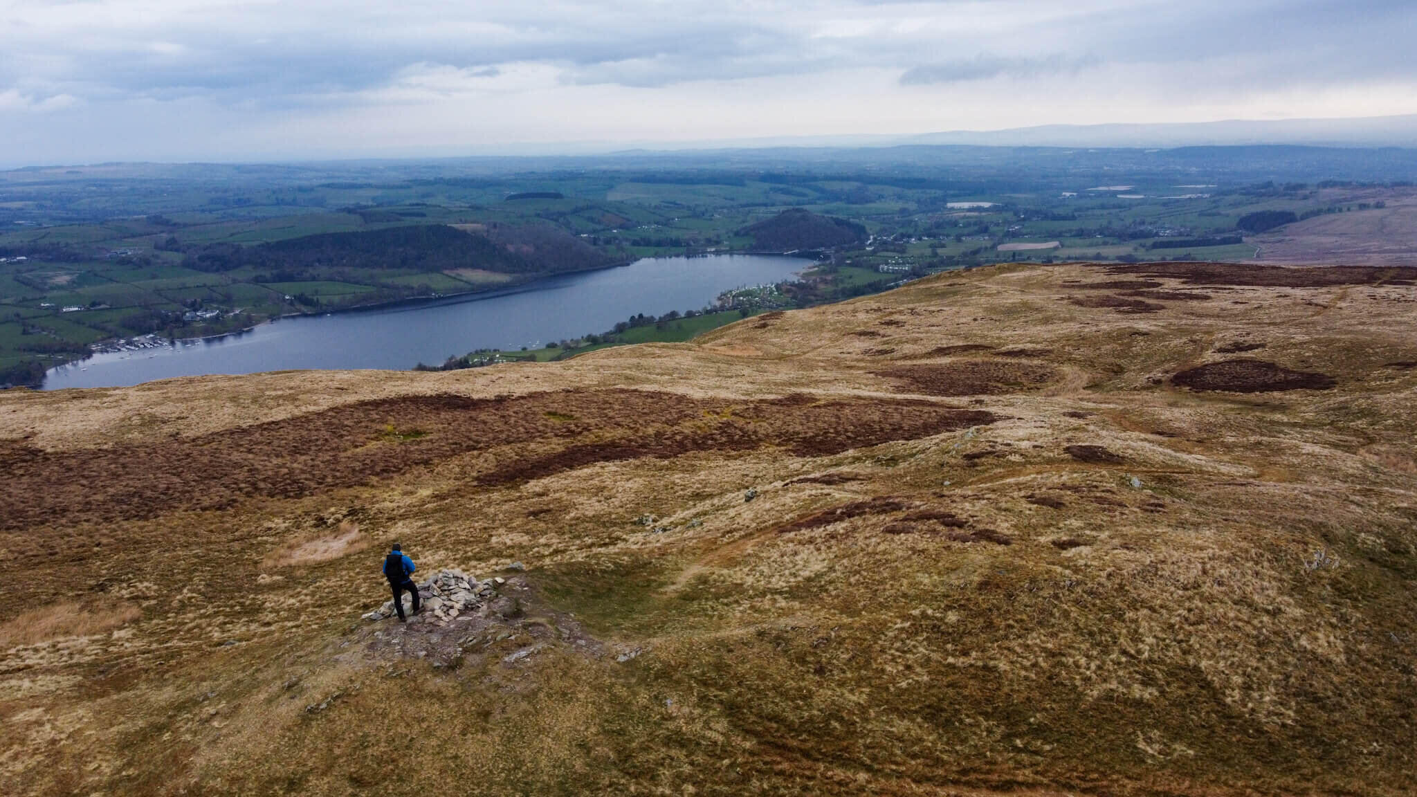
View From Bonscale Pike Towards Hallin Fell
My Bonscale Pike and Arthur’s Pike walk is a circular route that encompasses two Wainwrights whilst also passing over Swarth Fell.
This post covers the route that I took to walk Bonscale Pike and Arthur’s Pike, however as with all outdoor activities caution should be taken and you should ensure you have the correct equipment, knowledge and understanding to complete your walk. With this in mind, other routes are available and may be more suitable, so proceed with caution. For example, my route up Swarth Fell is steeper than alternative paths. Other more subtle paths are available and should be considered.
This route offers exceptional views across Ullswater towards Hallin Fell and Beda Fell as well as towards Pooley Bridge and Dunmallard Hill in the distance.
WALK OVERVIEW
Start - Howtown Pier
Parking is available at Howtown Pier on the roadside. Be sure not to park in the passing places as these are vital to ensure traffic can flow. If the roadside parking is full or you fancy a shorter walk, you can also park at the Church in Martindale.
OS Grid Ref: NY 443 198
Distance - 9.5km / 5.9 miles
Duration - 3hr- 4 hrs
There are plenty of opportunities to extend this walk so if you are looking for a longer walk consider adding in stops at Loadpot Hill and Wether Hill.
Difficulty - Moderate
The route I have chosen does include a section that I consider to be steep (going up Swarth Fell). I enjoyed this part of the route but it also gave me plenty of opportunity to stop, catch my breath and take in the views of Ullswater.
It is possible to do this route in reverse which will give you a mellower walk up however a steeper descent.
Total Ascent - 523m
Map - You can find my full route here on Ordance Surveys website

Arthurs Pike and Bonscale Pike Route
BONSCALE PIKE AND ARTHUR’S PIKE WALK VIDEO
PREPARING FOR YOUR BONSCALE PIKE & ARTHUR’S PIKE WALK
NAVIGATION
As with all good walk preparation, you will need a way to navigate on your walk. I use the OS Maps App on my phone and you can find my route here
If you are navigating using your phone be sure to do the following;
Download the map before you leave wifi - you CANT guarantee you will have signal in the mountains.
Print a copy of the walk before you leave from the Ordnance Survey Website as a backup.
WEATHER
If there is one thing that is for certain when walking in the British Mountains is that you can never be sure of the weather. Even on days that are forecast glorious sunshine, it is best to be prepared for the worst as conditions can change rapidly.
Check the latest Arthur’s Pike weather here
WHAT TO WEAR
When hiking in the UK it is important to remain flexible and with this in mind, layers are certainly your best option. Mountain environments can be unforgiving and weather can change quickly. It is normal to see winds increasing and temperatures dropping as you reach your chosen summit. Make sure to pack a spare layer for the summit.
Suitable footwear in the form of walking boots or shoes is advised, especially when conditions are less than ideal. A good pair of walking boots will offer your ankles support, keep your feet dry and ensure you have grip, especially on those wet days. Yes, you probably could make it to the top in that old pair of tennis trainers… but will your feet thank you?

WHERE TO START
Arriving at the start of the walk you will need to drive down some narrow country roads towards Howtown from Pooley Bridge. If possible, try to avoid peak times as traffic can be bad with few places to pass. It is important to keep an eye out for the last passing place as it is not uncommon for you to need to reverse back down the road.
The postcode for Howtown if you are using your Sat Nav is CA10 2LZ and this should lead you to the Howtown Pier. Parking is possible by the Pier on the roadside but this is limited.
As an alternative access to Howtown, consider taking a trip on the Ullswater steamers.

Parking in Howtown is free but be sure to be considerate of other road users. The road is used by farm vehicles and blocking it could result in your car getting ‘bumped’ by a tractor. It is not uncommon during peak times to see cars parked in passing places, don’t be that person.
FACILITIES
Unlike more popular areas of the Lake District, like Keswick and Windermere, there are no facilities in Howtown. To me, this is a positive as it draws fewer people but it is worth noting you should be prepared for a wild wee if you get caught short. There is a bar at the Howtown Hotel which is great for a post-walk pint.
HOWTOWN PIER TO BONSCALE PIKE AND ARTHURS PIKE ROUTE
Beginning your walk from Howtown Wyke, you will need to take the access gate to the left of the Outward Bound facility entrance. This gate will give you access to a field often home to sheep who don’t worry are more than used to company. Follow the trodden path through the centre of this field towards the upper corner near the houses. Here you will find a small set of steps and another gate that will lead you out onto the public footpath.
There are two options here, left for the mellow route or right for the direct route up Swarth Fell. The path up Swarth Fell follows a steeper path that zig-zags its way to the top at 504m. From here the hard work is done with 361m of ascent already being gained.
Hallin Fell as seen from Bonscale Pike
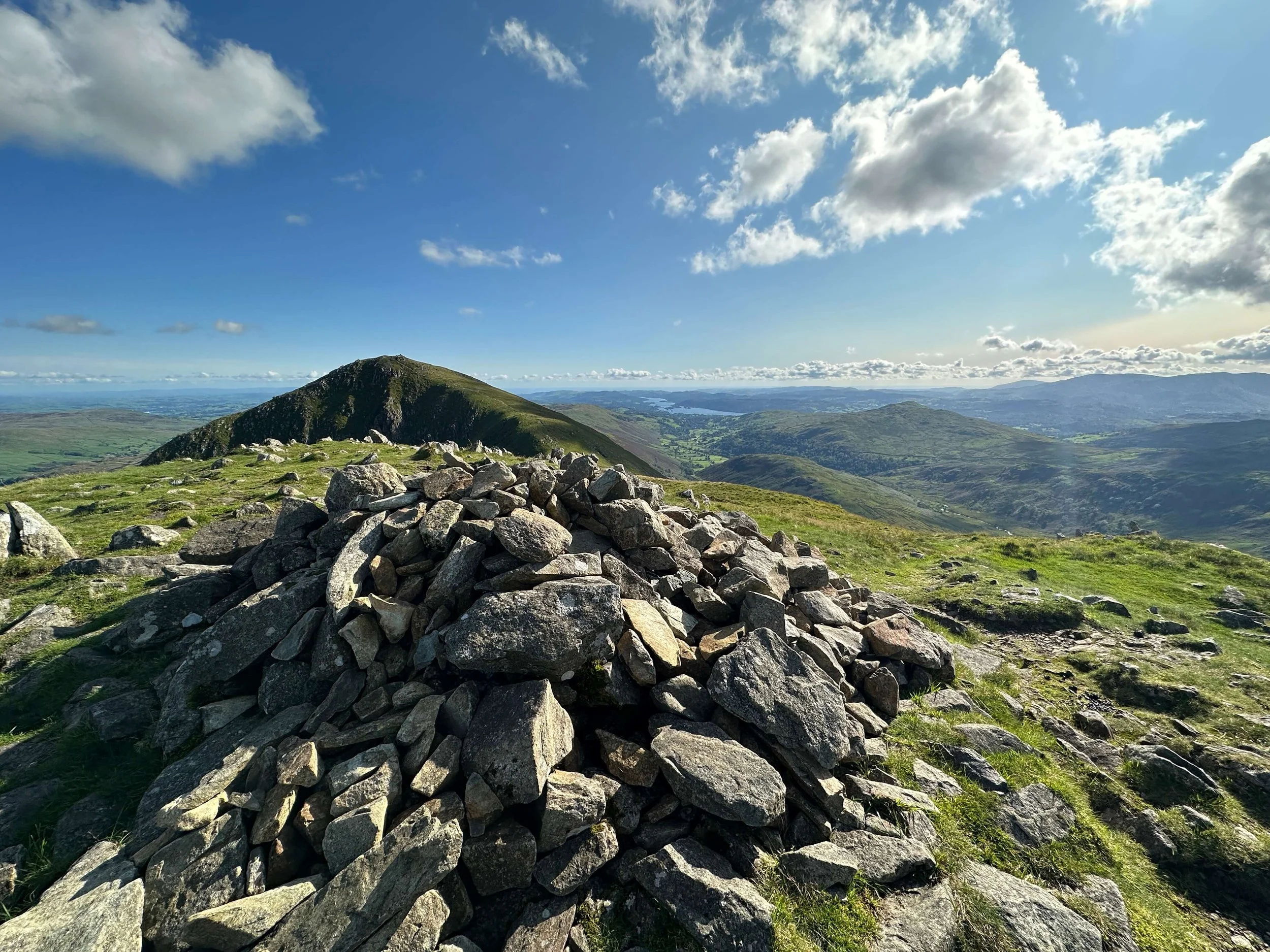
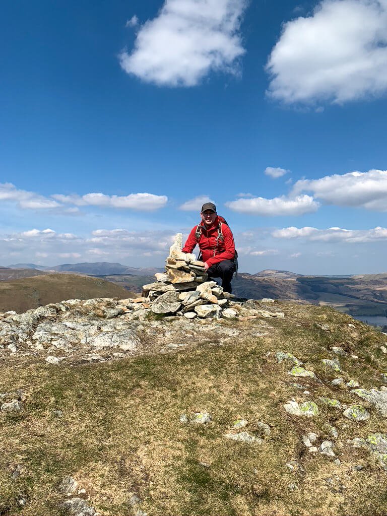
There is a path, not shown on OS maps, that links Swarth Fell and Bonscale Pike with only around 500m of walking between the two summits. The summit of Bonscale Pike is marked with a small Cairn with two towers, Bonscale Towers, slightly further along.
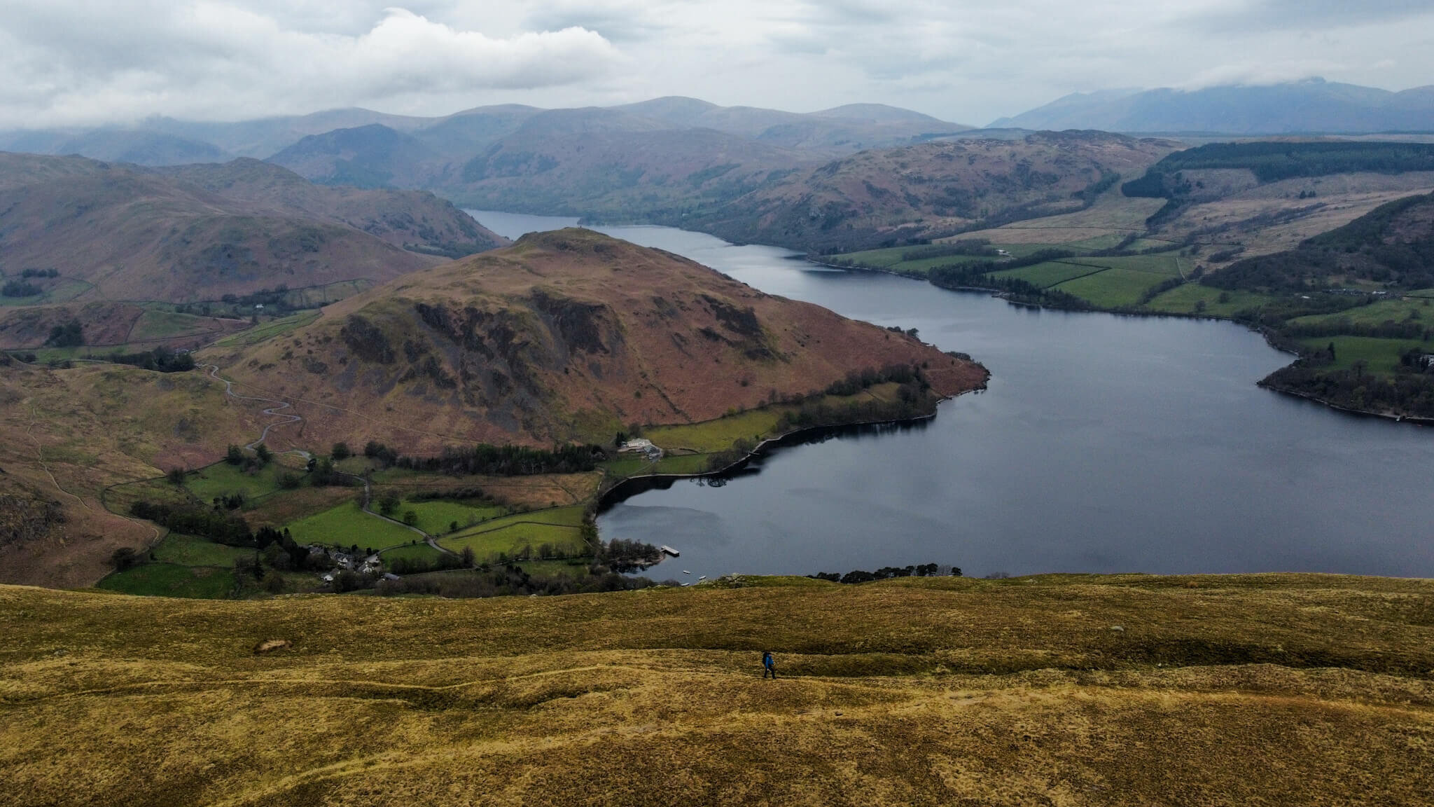
At Bonscale Pike it is worth taking in the views of Ullswater and the surrounding Fells. From here you have a clear view of Hallin Fell which is one of my favourite Lake District Fells.
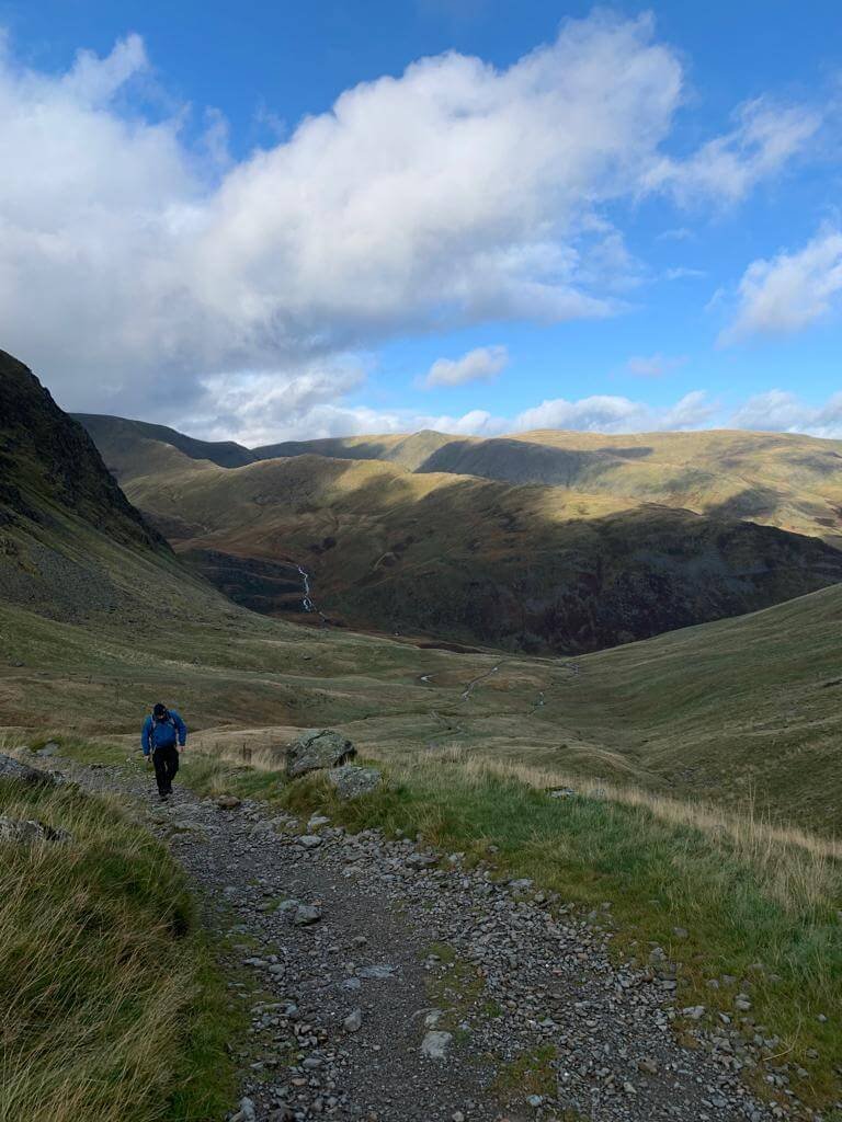
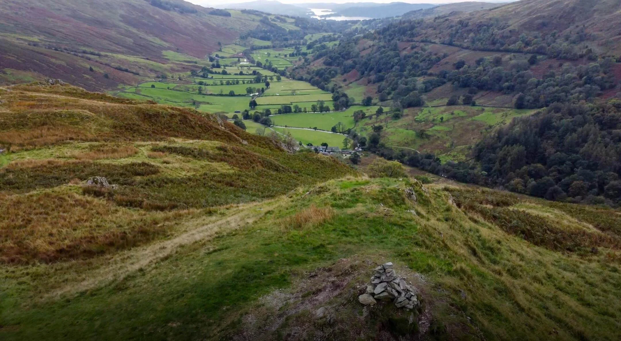
From Bonscale Pike you will need to descend slightly and cross Swarth Beck. You will notice and old stone building that has seen better days, this is an ideal place to cross the waterway and refill any water bottles. Onwards and upwards from here for the final push towards Arthurs Pike.
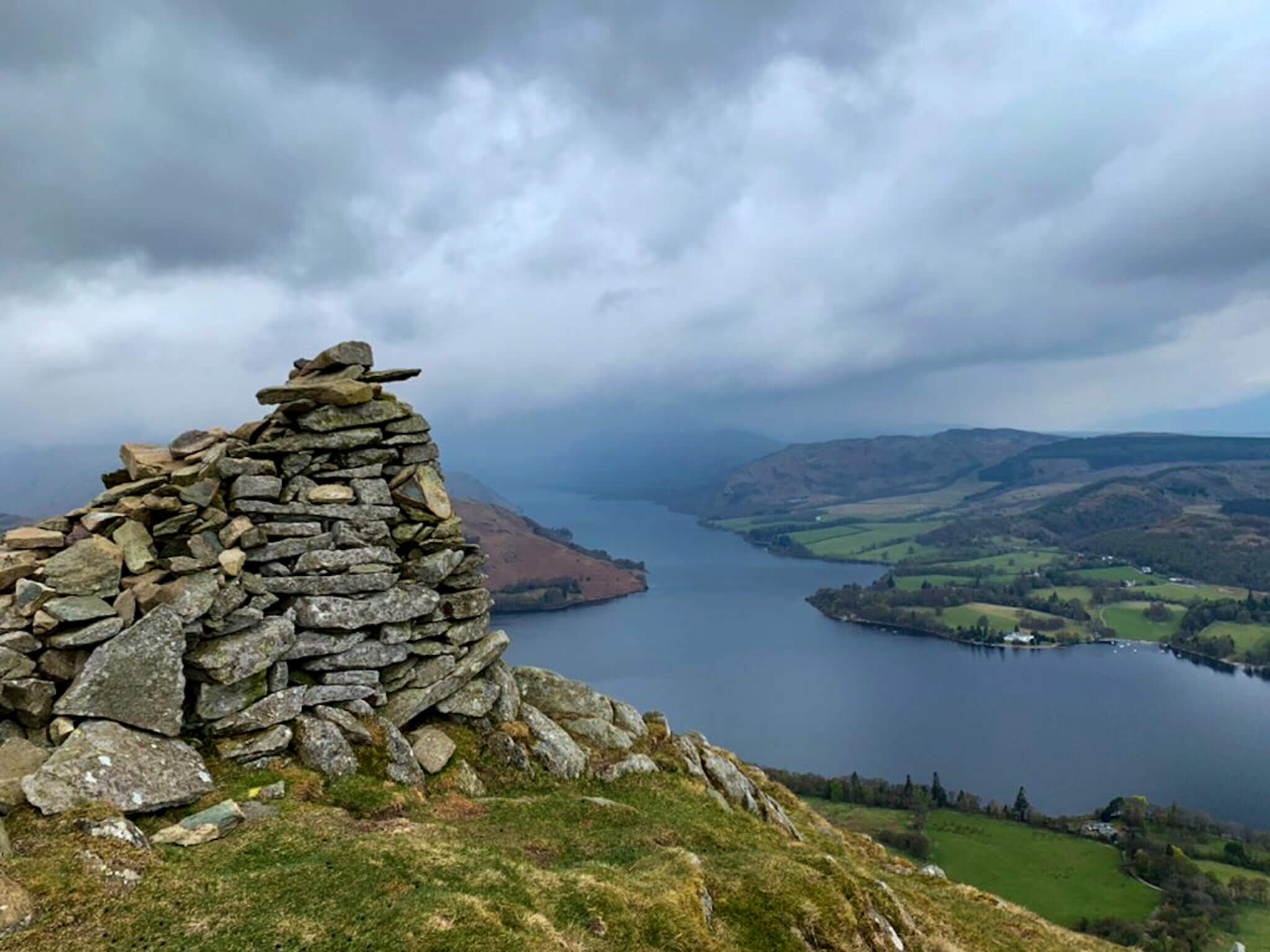
Arthur’s Pike Cairn
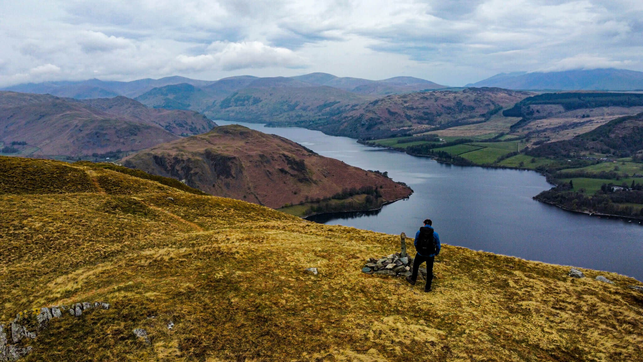
The path from here is well-trodden and clear leading the way to a small cairn that sits atop Arthur’s Pike. Although it is possible to continue your walk from here I would advise finding the larger Cairn atop Whinny Crag as the perfect spot to take in the views. On a clear day, this viewpoint offers unobstructed views of Ullswater Lake and is an ideal place to watch the steamers.
It is this spot that I chose to cook my breakfast and enjoy the views during Episode 3 of #mywainwrightsproject

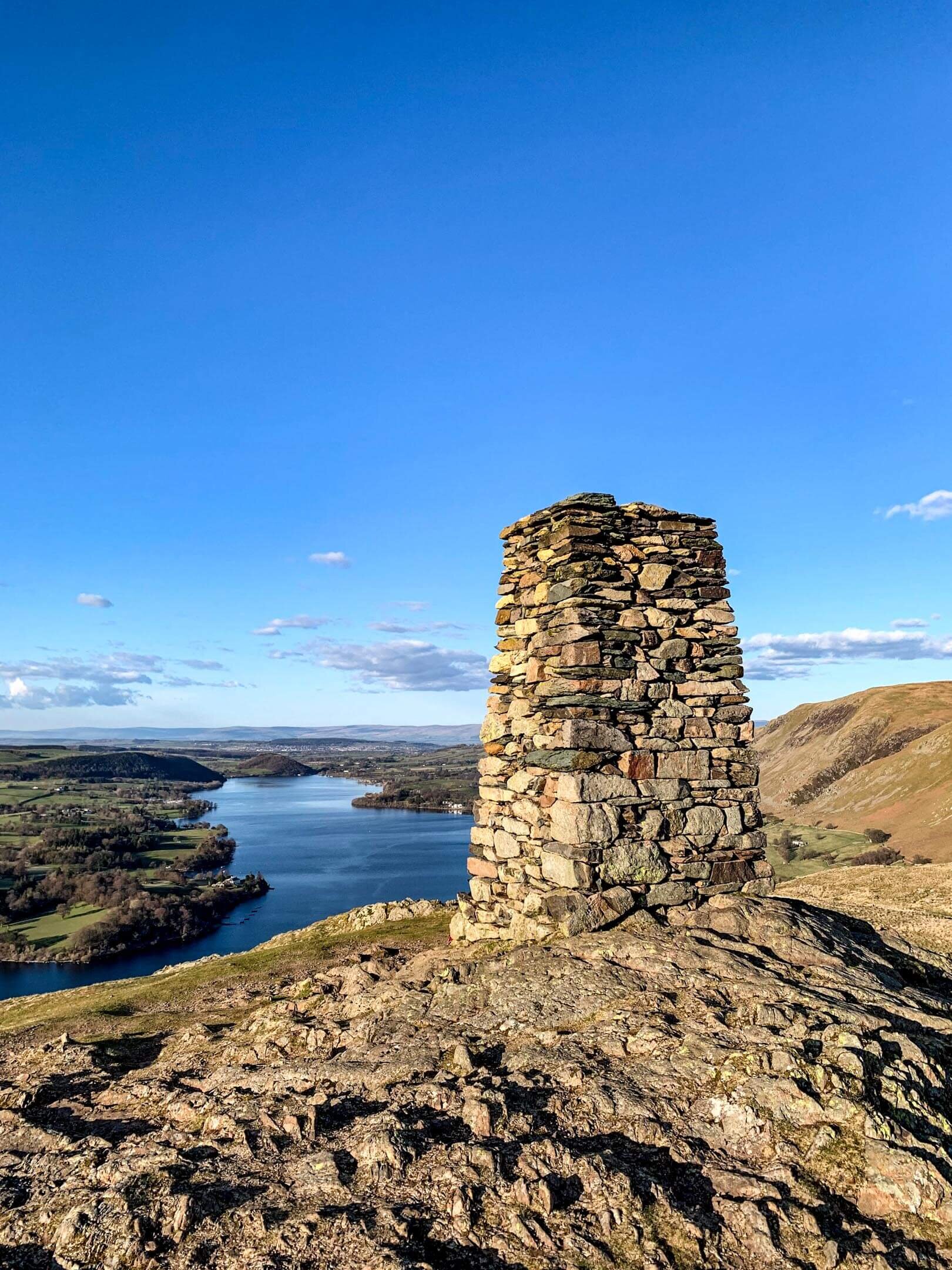
Cairn at Whinny Crag
When you decide it is time to head down from Arthur’s Pike, you will follow the path between Arthur’s Pike and White Knott. The walk down to White Knott is mellow with the path descending 100m over 1.5km of walking.
Similarly to the previous summits, White Knott also has impressive views across Ullswater. The path extends past White Knott before cutting back on itself just before Aik Beck. Keeping Barton Park on your right, follow the path past Ravencragg back towards Howtown.
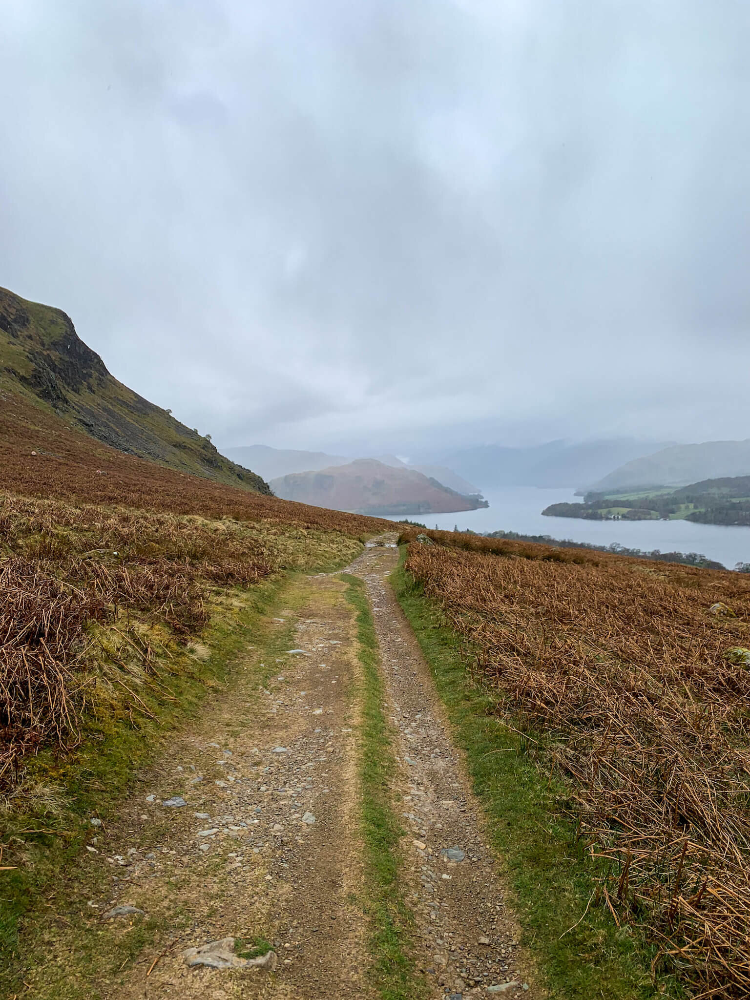
Path back to Howtown
Once atop Swarth Fell this walk offers incredible continuity in the views of Ullswater and the surrounding fells. Although the walk up Swarth Fell can be considered hard work, the rest of this walk is much more mellow. Whether atop; Swarth Fell, Bonscale Pike, Arthur’s Pike or White Knott the views across the Lake stretch from Pooley Bridge to Aira Point, before disappearing behind the prominent Fells.
TOP TIPS FOR WALKING BONSCALE PIKE & ARTHUR’S PIKE
Parking in Howtown can be limited so set off early at peak times. During weekends, evenings and holiday periods Howtown are popular so plan accordingly. With this in mind if you arrive in Howtown and find there is no parking don’t be that person who blocks the road by parking in a passing place!
There are steep sections on this walk so do some forward planning and allow for rest breaks. Hiking poles are a godsend on steeper pitches and can help relieve backspin if carrying a pack.
Pack for a change in weather. This walk should take a moderately fit individual two-three hours. Weather wise a lot can change in that time so consider packing some layers in your backpack.
Having the ability to navigate is essential, especially in incremental weather. You can follow my route on the OS Maps App here on any smartphone.
If you are relying on your phone for navigation, bring a battery pack or a way to charge your device.
Take some lunch with you! There are so many nice spots to stop, eat and enjoy the views.
Thanks for reading this post. If this post provided value for you then you can support me in making future content by using the link below to Buymeacoffee
Alternatively you can use the tip jar: https://paypal.me/sjburgess87?locale
View back towards Beda Fell
MORE FROM THE FAR EASTERN FELLS