Hallin Fell and Steel Knotts Walk | Lake District Walks
If you are looking for a short walk that offers exceptional views, it really is hard to beat Hallin Fell. In Wainwright’s own words Hallin Fell is “beautifully situated overlooking a curve of Ullswater and commanding unrivalled views“. Combining Hallin Fell with Steel Knotts makes for a beautiful circular walk that takes in some of the best views in the Far Eastern Fells.
This Hallin Fell and Steel Knotts walk ensures scenic views of lakes, valleys and distant peaks whilst ticking two Wainwrights of your list.
This post covers the route that I took to climb Hallin Fell and Steel Knotts, however as with all outdoor activities caution should be taken and you should ensure you have the correct equipment, knowledge and understanding to complete your walk. With this in mind, other routes are available and may be more suitable, so proceed with caution. An example being my route up Birkie Knotts was the most direct route. Other more subtle paths are available and should be considered.
That being said, this route is popular amongst Lake District walkers as it is fairly simple, short, but offers substantial rewards in regards to the views.
WALK OVERVIEW
Start - Howtown Pier
Parking is available at Howtown Pier on the road side. Be sure not to park in the passing places as these are vital to ensure traffic can flow. If the roadside parking is full or you fancy a shorter walk, you can also park at the Church in Martindale.
Tip - Park in Pooley Bridge and take the Ullswater Steamer to Howtown. The lake crossing certainly adds something special to any Howtown adventure.
Distance - 7.2km / 4.5 miles
You can reduce this by parking in Martindale, however, the stroll past Ullswater and Howtown Pier is nice and that’s why I included it in my walk.
Duration - 2hr 40 - 4 hr
Depending on fitness levels and how often you are stopping to take photos of the stunning Ullswater.
Difficulty - Moderate
It is hard to justify difficulty for me as everyone’s boundaries are different. That being said this walk is very achievable to the majority of people. You can ensure the route is easier by taking a more subtle path up Birkie Knotts which could be quite steep to some.
Total Ascent - 512m
Map - You can find my full route here on Ordance Surveys website
PREPARING FOR YOUR HALLIN FELL & STEEL KNOTTS WALK
NAVIGATION
As with all good walk preparation you will need a way to navigate on your walk. I use the OS Maps App on my phone and you can find my route here
If you are navigating using your phone be sure to do the following;
Download the map before you leave wifi - you CANT guarantee you will have signal in the mountains.
Bring a battery pack or way to charge your device.
Print a copy of the walk before you leave from the Ordance Survey Website as a back up.
I also use my Suunto Watch as a backup navigation tool, however if you are not confident that your technology will last you should purchase the Ordnance Survey Map for your walk.
WEATHER
If there is one thing that is for certain when walking in British Mountains is that you can never be sure of the weather. Even on days that are forecast glorious sunshine it is best to be prepared for the worst, as conditions can change rapidly.
Check the latest Hallin Fell weather here
WHAT TO WEAR
When hiking in the UK it is important to remain flexible and with this in mind layers are certainly your best option. Mountain environments can be unforgiving and weather can change quickly. It is normal to see winds increasing and temperatures dropping as you reach your chosen summit. Make sure to pack a spare layer for the summit.
Suitable footwear in the form of walking boots or shoes is advised, especially when conditions are less than ideal. A good pair of walking boots will offer your ankles support, keep your feet dry and ensure you have grip especially on those wet days. Yes, you probably could make it to the top in that old pair of tennis trainers… but will your feet thank you?
WHERE TO START
Getting to the start of the walk involves driving down some narrow country roads towards Howtown and Martindale from Pooley Bridge. Be careful as traffic can be busy at peak times and there are few places to pass. It is important to keep an eye out for the last passing place as it is not uncommon for you to need to reverse back down the road.
The postcode for Howtown if you are using your Sat Nav is CA10 2LZ and this should lead you to the Howtown Pier. Parking is possible by the Pier on the roadside but this is limited.
If you fancy a cool alternative to access Howtown consider taking a trip on the Ullswater steamers.

Parking is also possible by St Peter’s Church in Martindale. The church sits at the base of the paths to Hallin Fell and Steel Knotts so is ideally located. This area can become busy so be sure to head up early or late to guarantee a parking spot.
Parking in both Howtown and Martindale is free but be sure to be considerate of other road users. The road is used by farm vehicles and blocking it could result in your car getting ‘bumped’ by a tractor.
FACILITIES
Unlike more popular areas of the Lake like Keswick and Windermere there are no facilities in Howtown and Martindale. To me this is a positive as it draws less people but it is worth noting you should be prepared for a wild wee if you get caught short.
HOWTOWN PIER TO HALLIN FELL VIA STEEL KNOTTS ROUTE
Starting your walk from Howtown Pier is nice as it means you begin your walk at water level with a scenic stroll along the edge of the lake. Parking by the pier in Howtown can be tough to come by during peak times. Consider setting of early to ensure a parking space. Alternatively, use the Ullswater Steamers boats from Pooley Bridge to drop you in Howtown. You can find the timetable here.
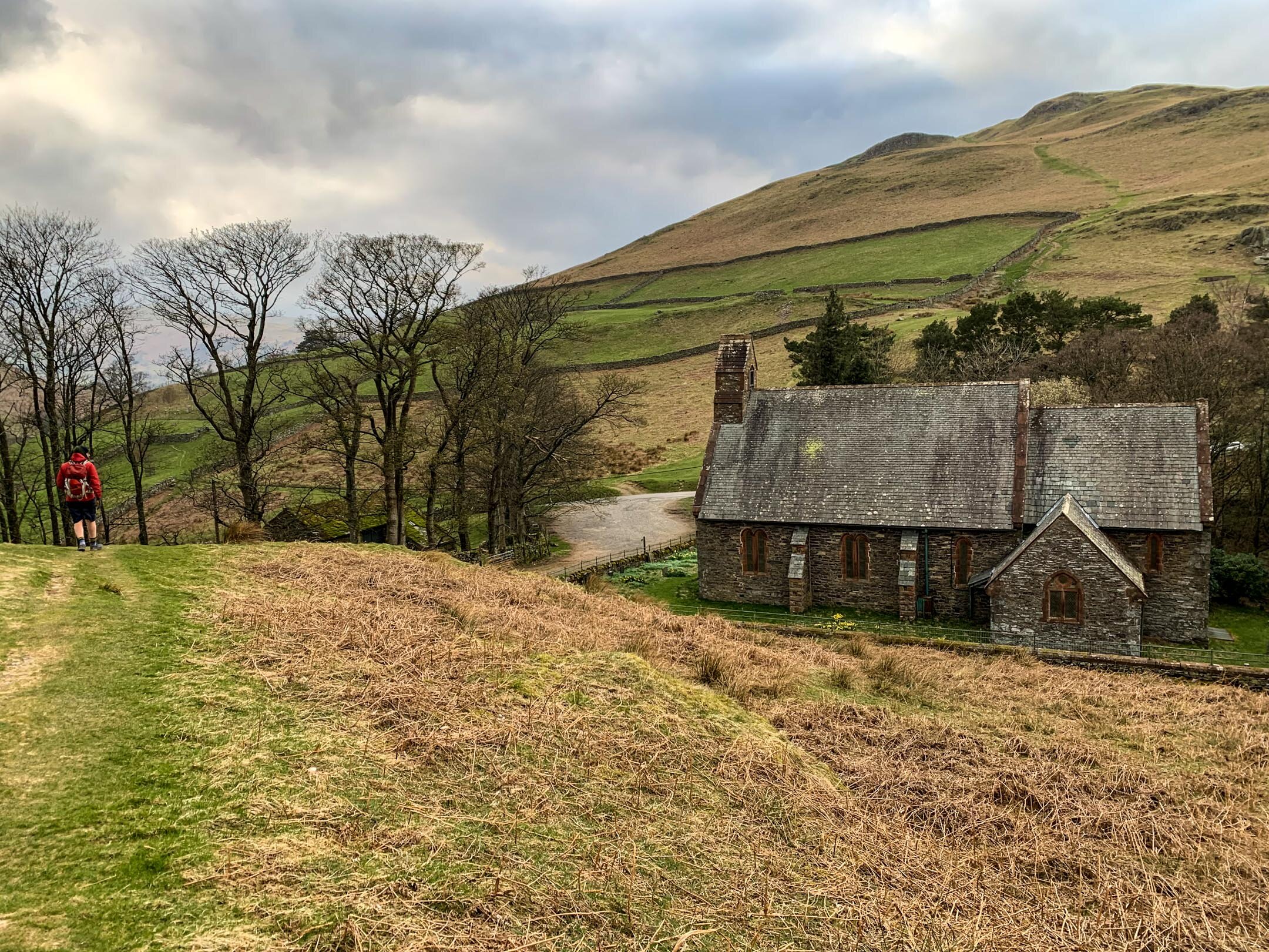
Taking the footpath along the Lake leads to a set of narrow steps that lead you onto the base of Hallin Fell. Taking a right at the top of the steps leads you on a beautiful walk around the base of Hallin Fell, but I will save that for another day. Turn left and follow the path up towards Martindale. The path overlooks a winding road that leads to Martindale and the path meets the road at the top by St Peter’s Church.
When you reach the Church of St Peter in Martindale it is likely you will see cars parks along the road. This is an alternative starting point to your walk.
Wherever you choose to start your walk you will need to follow the footpath behind the Church towards Birkie Knott. The path up Birkie Knotts is steep but well trodden with a clear footpath to follow. I prefer taking the steeper route up, however if you prefer, it is possible to take a more mellow route to the right of Birkie Knott.
A brief stop at the top of Birkie Knott will be well deserved and rewarding with views looking back towards Pooley Bridge and Dunmallard Hill. This is also a pretty decent spot to watch the steamers pulling into Howtown.
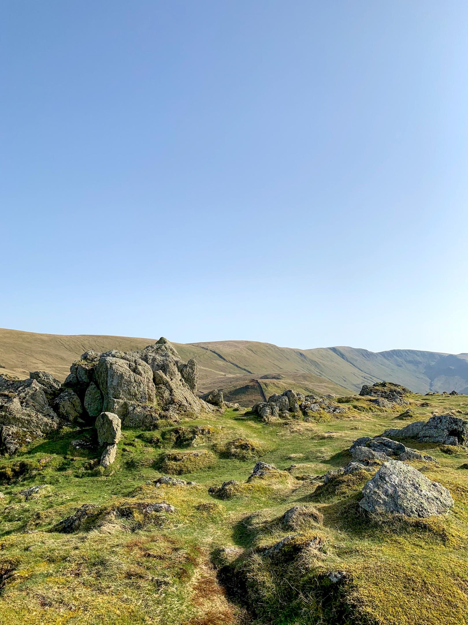
Steel Knotts Pikeawassa Summit
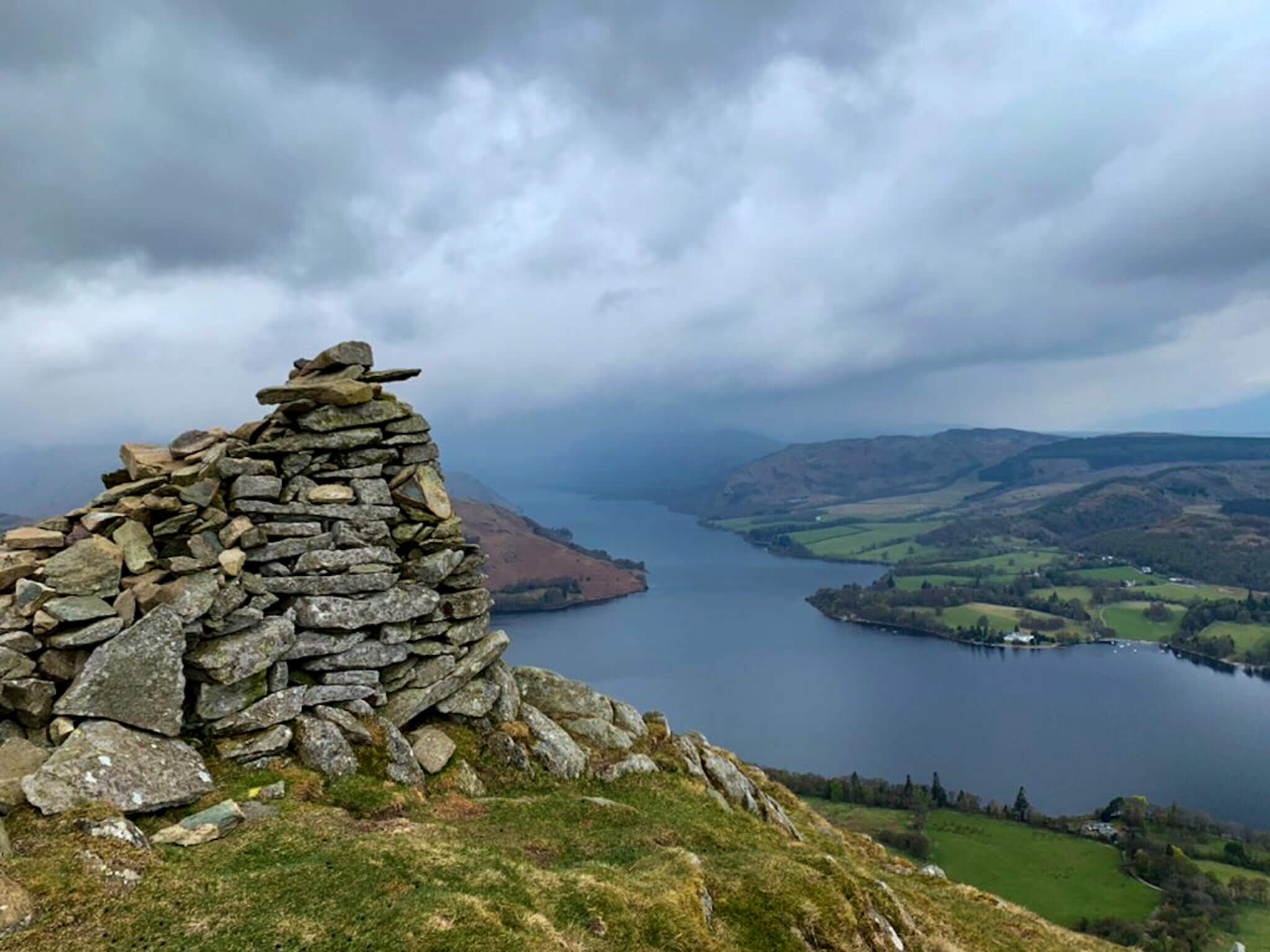
Continue onwards towards Steel Knotts along the mellow but winding path that runs along the ridge. The rocky ridge of Steel Knotts is unmistakable with a imposing summit name Pikeawassa. The ridge itself is around two miles in length and overlooks the steep valley of Fusedale. On a clear day you will be able to take in some beautiful views of the Martindale Horseshoe and the Helvellyn range from Pikeawassa. At 432m, Steel Knotts Pikeawassa is achievable for many and has to this point been one of my favourite Lake District summits.
To continue onwards to Hallin Fell take the path towards Brownthwaite Crag before meeting a stone wall. From the wall you will be able to see a path that loops back towards the church at Martindale. Running above Nettlehowe Crag, with some uninterrupted views of Beda Fell on the opposite side of the valley, this path is a really enjoyable aspect of this walk.
As mentioned, this path will lead you back to the church at Martindale and all you have to do is cross the road onto Hallin Fell. There are various paths up Hallin Fell with the most popular potentially being one of the steepest. You will see the wide, well trodden path leading its way up Hallin Fell and your only job is to follow it.
As seen from Hallin Fell
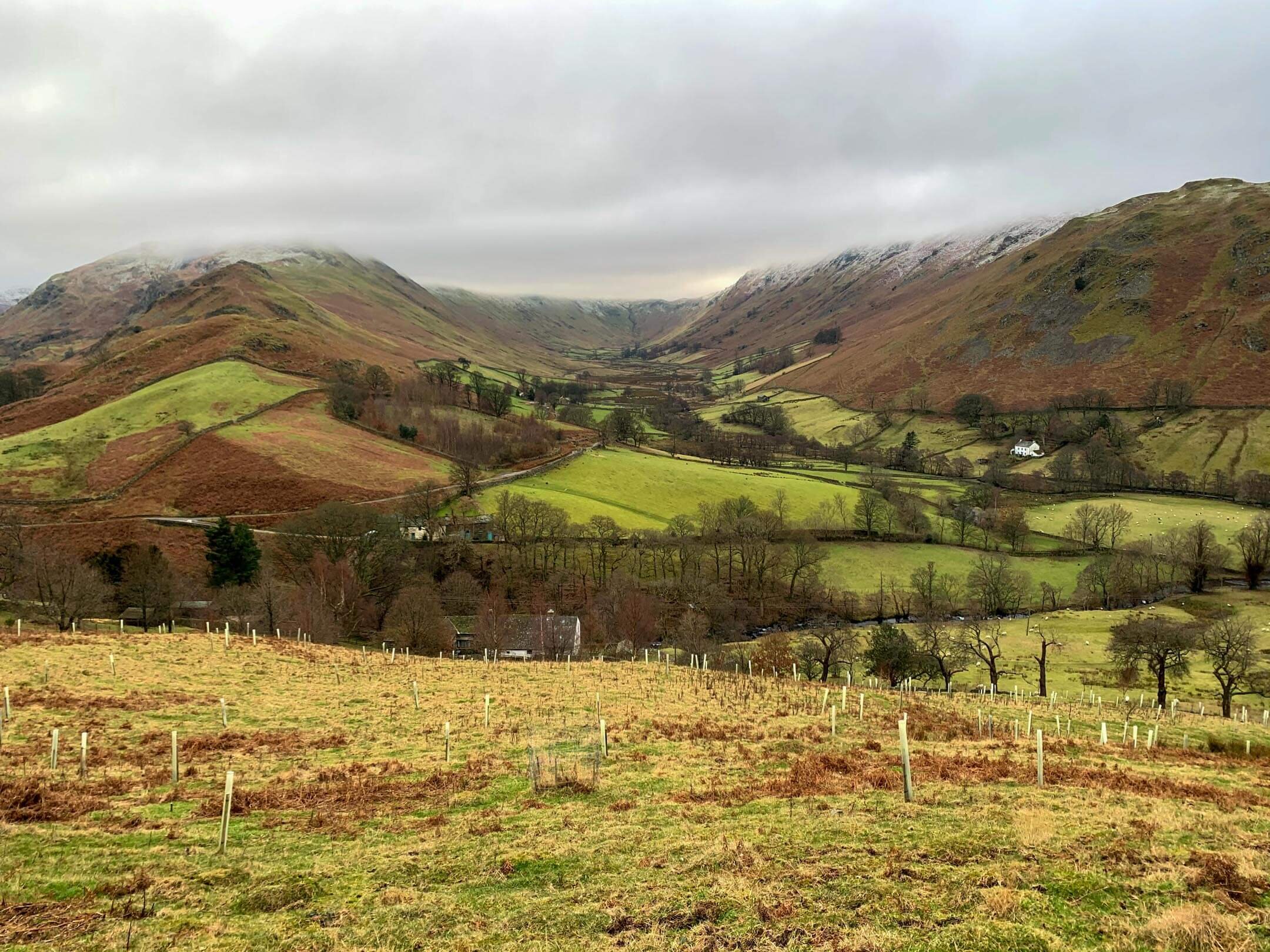
When walking the path up it is essential to take time to turn around and look at the scenery behind you. The views back towards the Martindale Horseshoe are impressive, letting your mind run away with the many possibilities of walking routes in the area. It was on this part of the walk that I decided to make Beda Fell Episode 2 in #mywainwrightsproject
WATCH EPISODE 2 BELOW
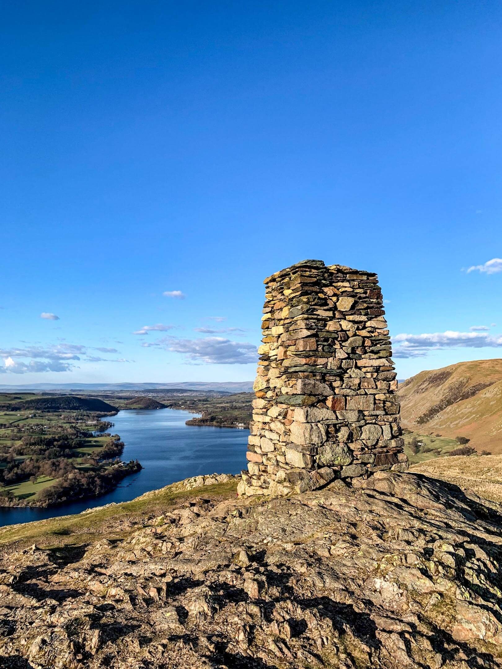
One of the most impressive parts of this route up Hallin Fell is just how well the path hides the views of Ullswater until, at the last minute, revealing stunning views of the lake on three sides of the fell. As you round the final bend at the top of the path the Obelisk reveals itself and it is hard not to feel blown away, and not by the Cumbrian wind. The views from Hallin Fell rival many places in the world where hills and mountains meet lakes or water. And it is this, combined with the simplicity of the walk, that makes Hallin Fell popular with walkers from all over the UK.
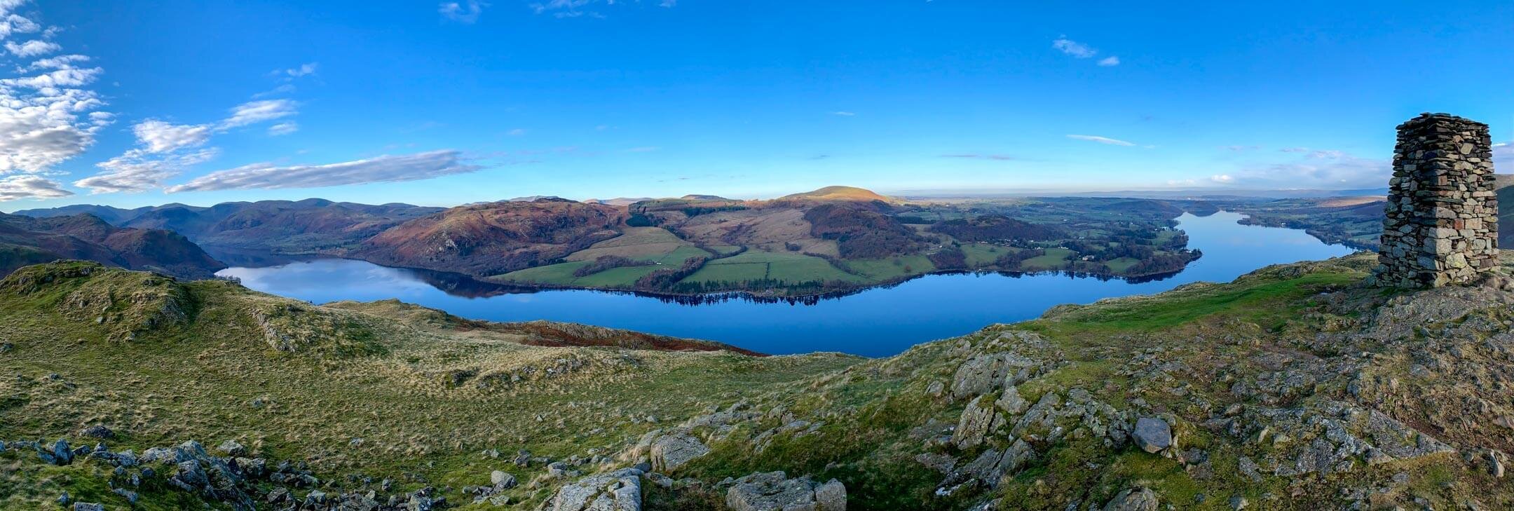
Incredible views from atop Hallin Fell
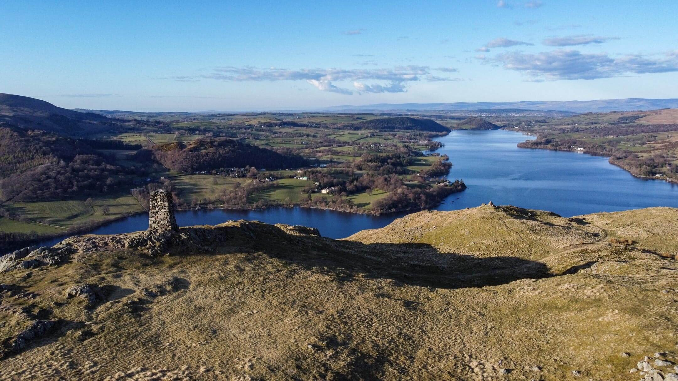
After you have filled your camera roll with the many epic panoramas visible from atop Hallin Fell it is time to descend. Again you have options here, however a personal favourite of mine is the steep route to the east leading back to Waternook. This route should be avoided in adverse whether as the gradient can make it difficult to maintain footing. In fair weather or for those experienced and prepared this pathway drops away towards the banks of the lake allowing the scenery to open up around you. It is from this descent that you will find your way back onto the original path leading to the staircase and Howtown.

Path back down Hallin Fell looking back towards Pooley Bridge and Dunmallard Hill
TOP TIPS FOR WALKING STEEL KNOTTS AND HALLIN FELL
Whether you are planning to park in Howtown or Martindale be prepared to set off early at peak times. During weekends, evenings and holiday periods Martindale and Howtown are popular so plan accordingly. With this in mind if you arrive in Howtown or Martindale and find there is no parking don’t be that person who blocks the road by parking in a passing place!
There are steep sections on this walk so do some forward planning and allow for rest breaks. Hiking poles are a godsend on steeper pitches and can help relieve backspin if carrying a pack.
Pack for a change in weather. This walk should take a moderately fit individual a two-three hours. Weather wise a lot can change in that time so consider packing some layers in your backpack.
The paths are fairly clear but bring some navigation to help you if adverse weather should arise. You can follow my route on the OS Maps App here.
If you are relying on your phone for navigation, bring a battery pack or a way to charge your device.
Take some lunch with you! There are so many nice spots to stop, eat and enjoy the views.
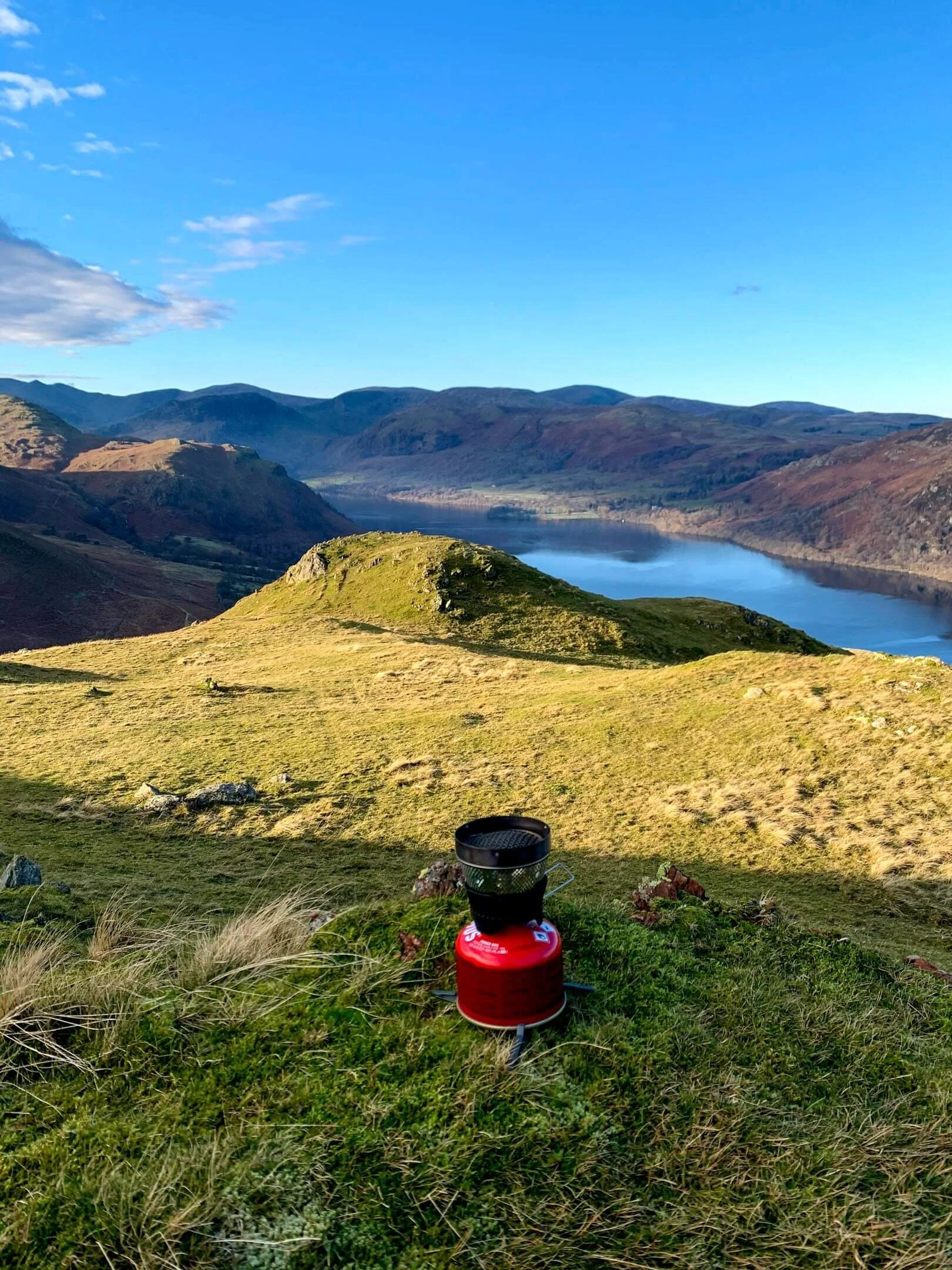
Preparing for breakfast on Hallin Fell
Are you planning a Steel Knotts & Hallin Fell Walk? Feel Free to ask me any questions in the comments!
Thanks for reading this post. If this post provided value for you then you can support me in making future content by using the link below to Buymeacoffee. T
Alternatively, you can use the tip jar: https://paypal.me/sjburgess87?locale

Views from atop Steel Knotts