


Bonscale Pike and Arthurs Pike Walk | Lake District Walks
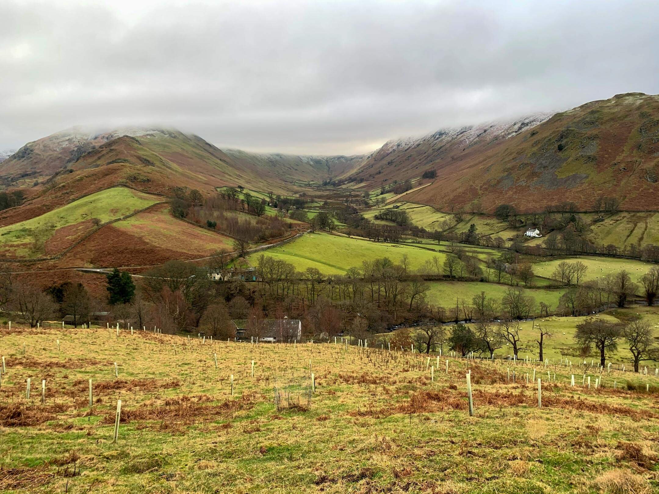
The town of Howtown on the Eastern shores of Ullswater is a fantastic access point for walking the Far Eastern Fells. These quieter, less accessed walking routes are away from the humdrum of Keswick and Kendal making the valley of Fusedale perfect for avoiding the crowds.
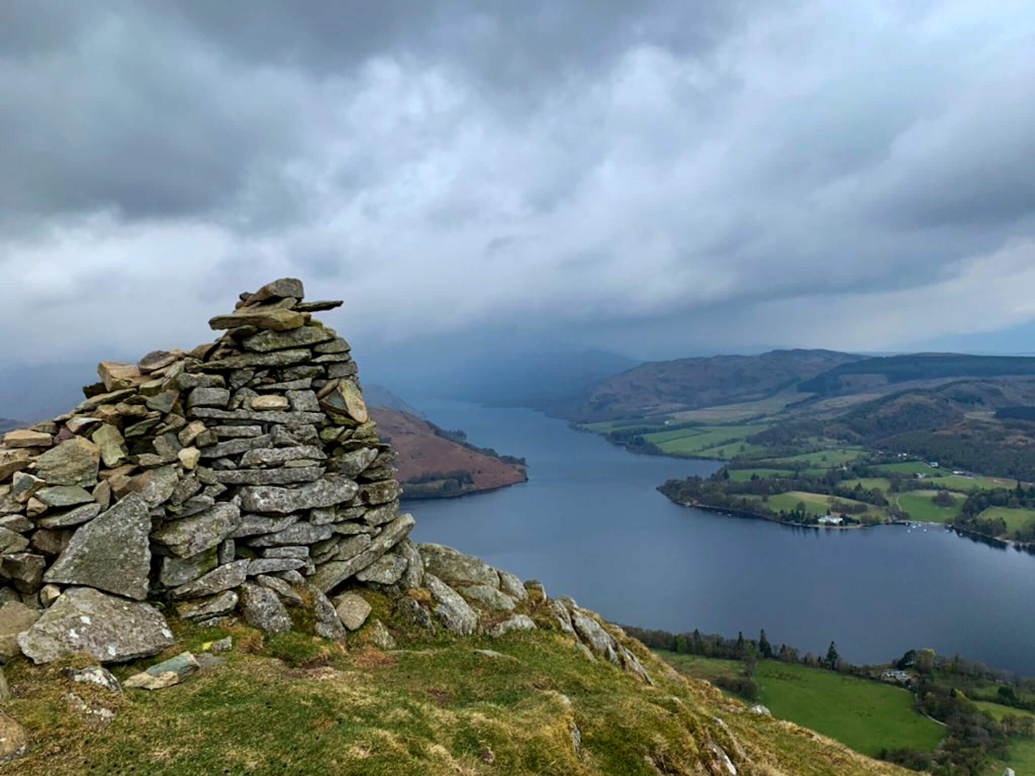
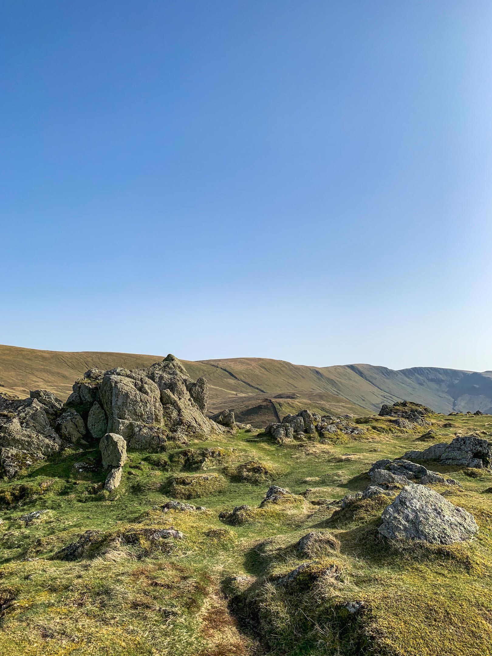
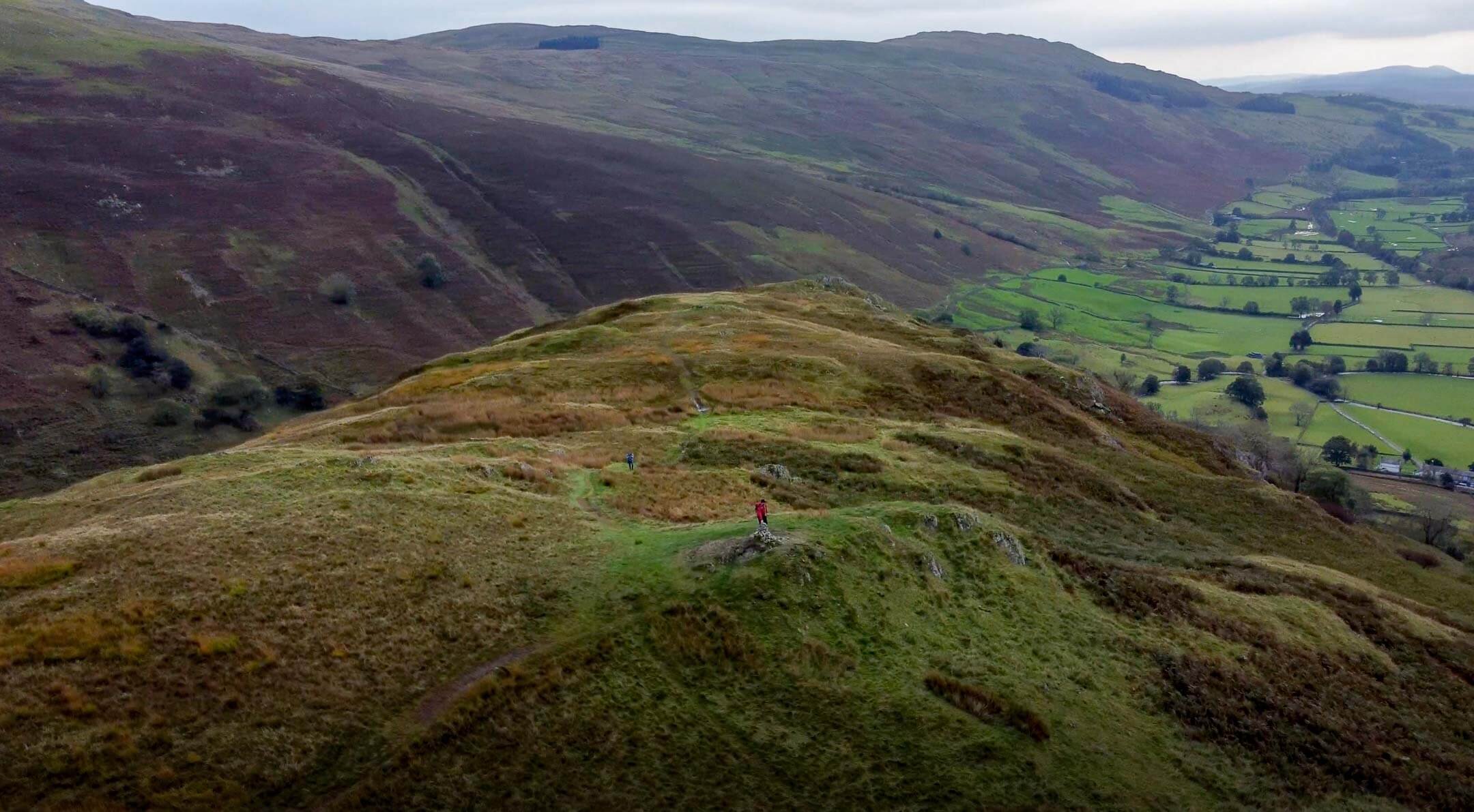
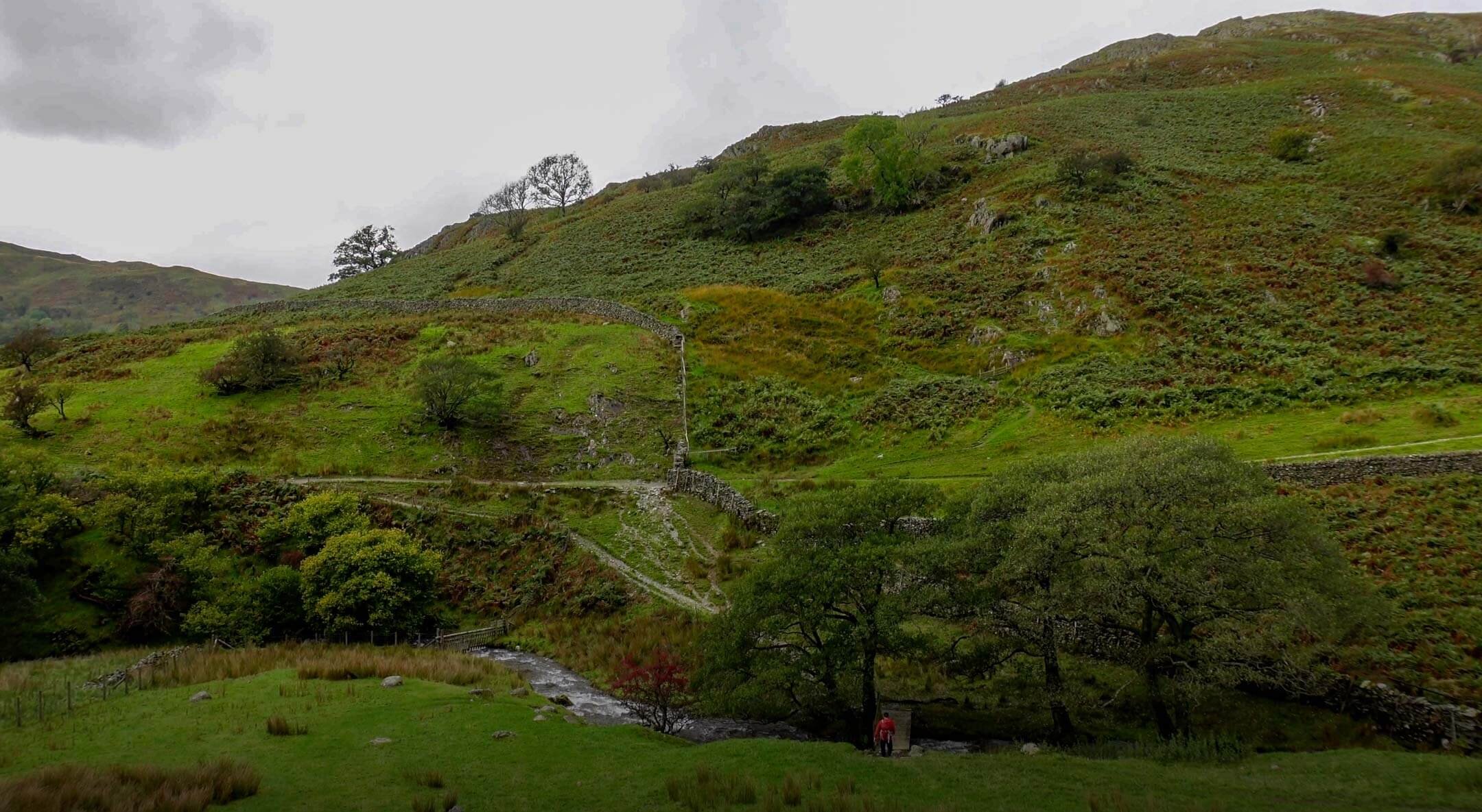
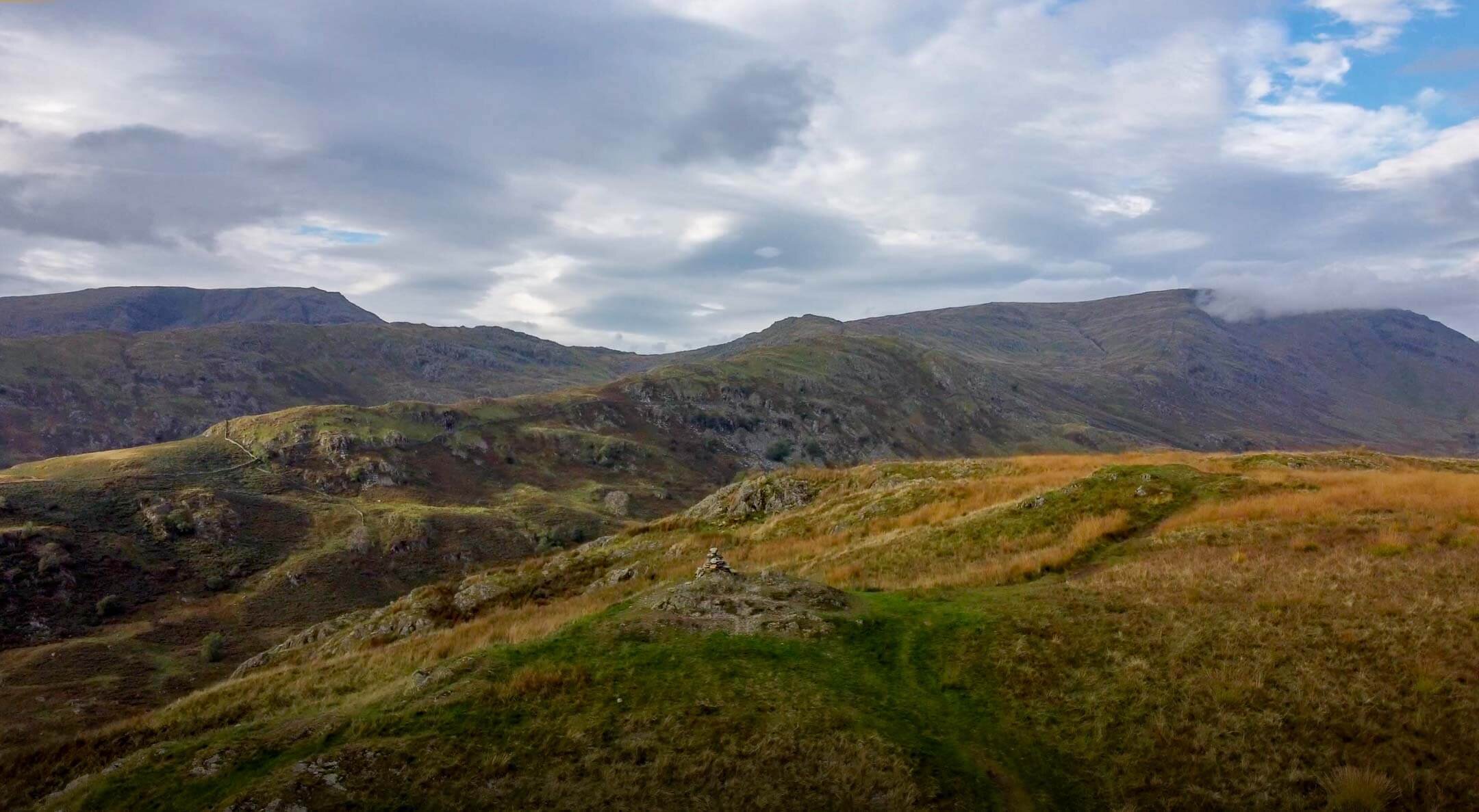
View From Bonscale Pike Towards Hallin Fell
My Bonscale Pike and Arthur’s Pike walk is a circular route that encompasses two Wainwrights whilst also passing over Swarth Fell.
This post covers the route that I took to walk Bonscale Pike and Arthur’s Pike, however as with all outdoor activities caution should be taken and you should ensure you have the correct equipment, knowledge and understanding to complete your walk. With this in mind, other routes are available and may be more suitable, so proceed with caution. For example, my route up Swarth Fell is steeper than alternative paths. Other more subtle paths are available and should be considered.
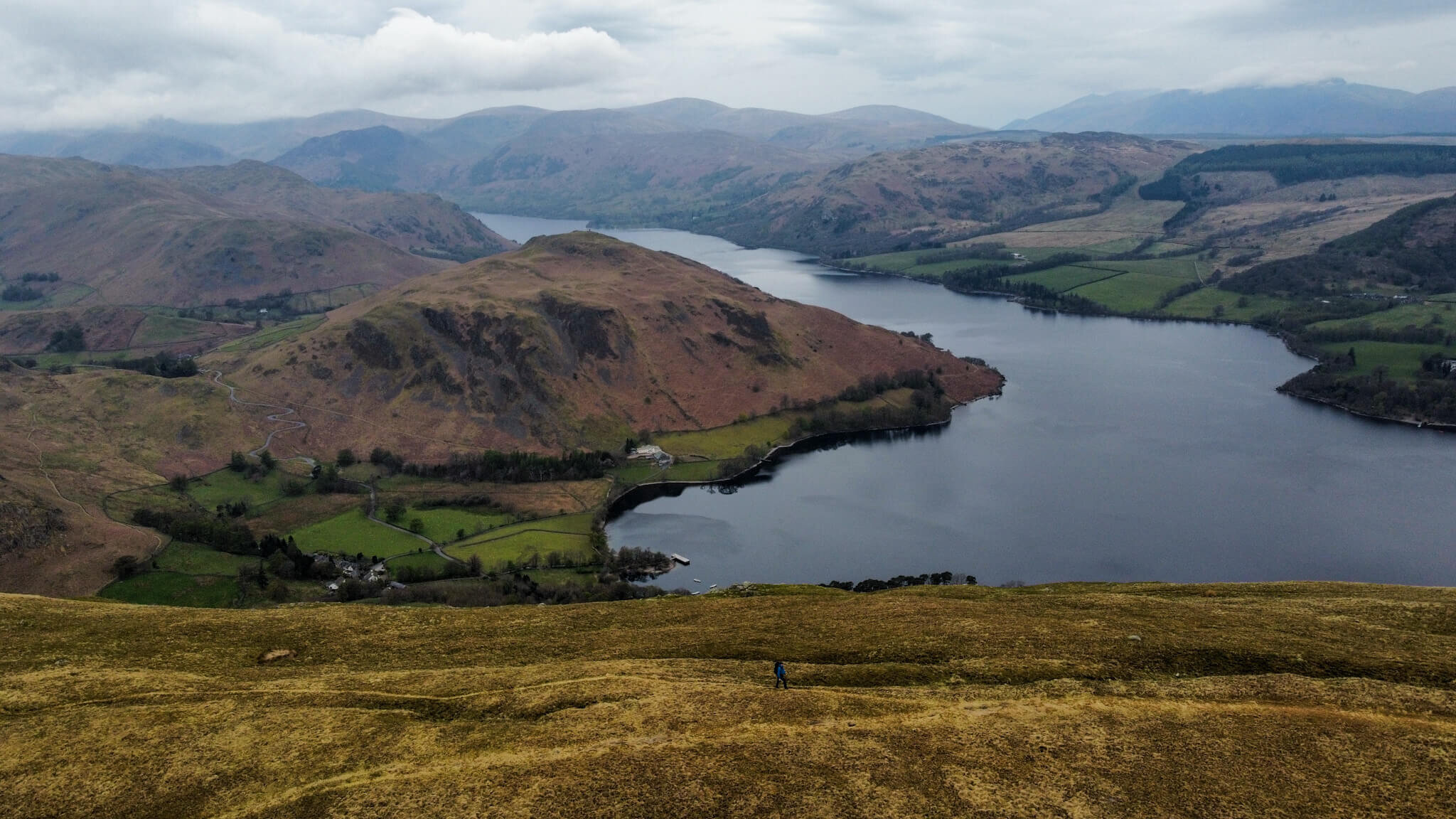
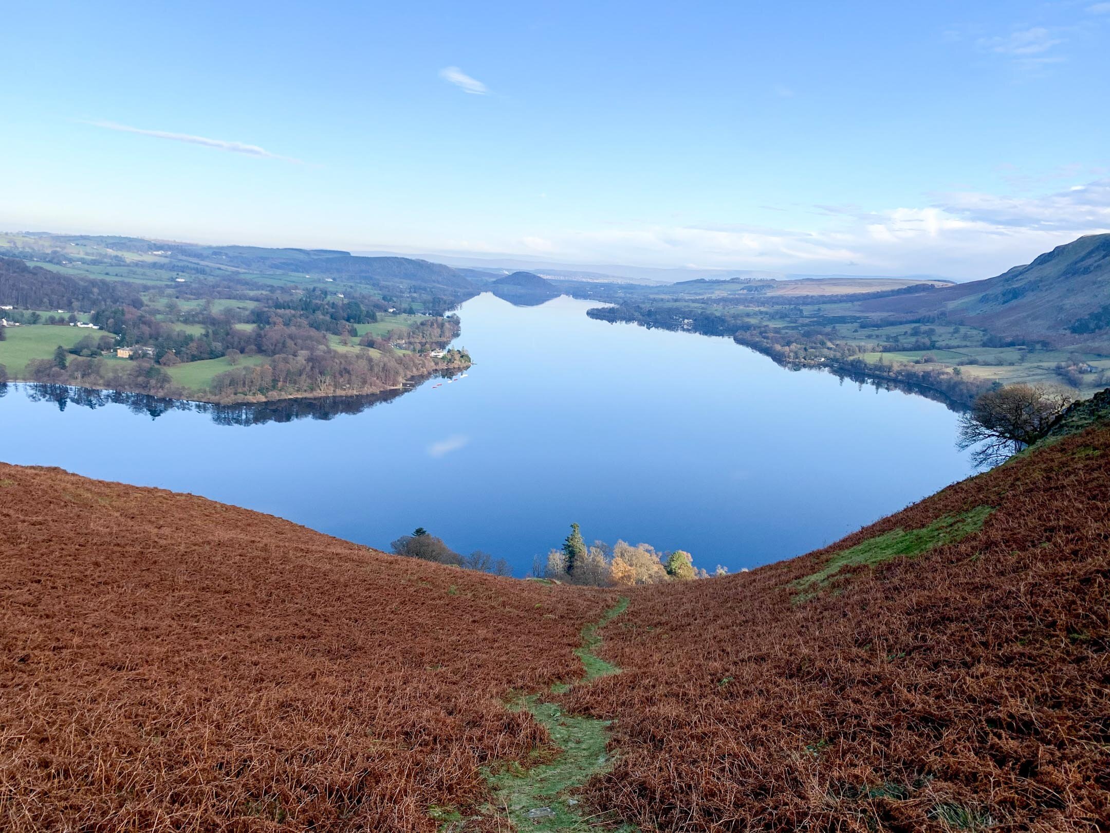
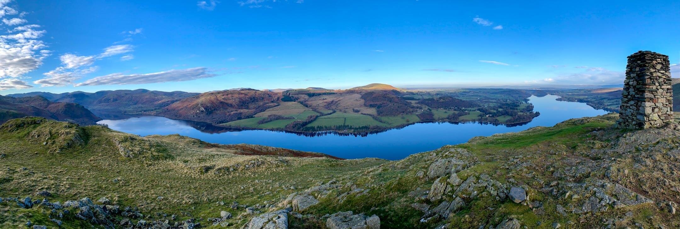
This route offers exceptional views across Ullswater towards Hallin Fell and Beda Fell as well as towards Pooley Bridge and Dunmallard Hill in the distance.
WALK OVERVIEW
Start - Howtown Pier
Parking is available at Howtown Pier on the roadside. Be sure not to park in the passing places as these are vital to ensure traffic can flow. If the roadside parking is full or you fancy a shorter walk, you can also park at the Church in Martindale.
OS Grid Ref: NY 443 198
Distance - 9.5km / 5.9 miles
Duration - 3hr- 4 hrs
There are plenty of opportunities to extend this walk so if you are looking for a longer walk consider adding in stops at Loadpot Hill and Wether Hill.
Difficulty - Moderate
The route I have chosen does include a section that I consider to be steep (going up Swarth Fell). I enjoyed this part of the route but it also gave me plenty of opportunity to stop, catch my breath and take in the views of Ullswater.
It is possible to do this route in reverse which will give you a mellower walk up however a steeper descent.
Total Ascent - 523m
Map - You can find my full route here on Ordance Surveys website

Arthurs Pike and Bonscale Pike Route
BONSCALE PIKE AND ARTHUR’S PIKE WALK VIDEO
PREPARING FOR YOUR BONSCALE PIKE & ARTHUR’S PIKE WALK
NAVIGATION
As with all good walk preparation, you will need a way to navigate on your walk. I use the OS Maps App on my phone and you can find my route here
If you are navigating using your phone be sure to do the following;
Download the map before you leave wifi - you CANT guarantee you will have signal in the mountains.
Print a copy of the walk before you leave from the Ordnance Survey Website as a backup.
WEATHER
If there is one thing that is for certain when walking in the British Mountains is that you can never be sure of the weather. Even on days that are forecast glorious sunshine, it is best to be prepared for the worst as conditions can change rapidly.
Check the latest Arthur’s Pike weather here
WHAT TO WEAR
When hiking in the UK it is important to remain flexible and with this in mind, layers are certainly your best option. Mountain environments can be unforgiving and weather can change quickly. It is normal to see winds increasing and temperatures dropping as you reach your chosen summit. Make sure to pack a spare layer for the summit.
Suitable footwear in the form of walking boots or shoes is advised, especially when conditions are less than ideal. A good pair of walking boots will offer your ankles support, keep your feet dry and ensure you have grip, especially on those wet days. Yes, you probably could make it to the top in that old pair of tennis trainers… but will your feet thank you?
WHERE TO START
Arriving at the start of the walk you will need to drive down some narrow country roads towards Howtown from Pooley Bridge. If possible, try to avoid peak times as traffic can be bad with few places to pass. It is important to keep an eye out for the last passing place as it is not uncommon for you to need to reverse back down the road.
The postcode for Howtown if you are using your Sat Nav is CA10 2LZ and this should lead you to the Howtown Pier. Parking is possible by the Pier on the roadside but this is limited.
As an alternative access to Howtown, consider taking a trip on the Ullswater steamers.

Parking in Howtown is free but be sure to be considerate of other road users. The road is used by farm vehicles and blocking it could result in your car getting ‘bumped’ by a tractor. It is not uncommon during peak times to see cars parked in passing places, don’t be that person.
FACILITIES
Unlike more popular areas of the Lake District, like Keswick and Windermere, there are no facilities in Howtown. To me, this is a positive as it draws fewer people but it is worth noting you should be prepared for a wild wee if you get caught short. There is a bar at the Howtown Hotel which is great for a post-walk pint.
HOWTOWN PIER TO BONSCALE PIKE AND ARTHURS PIKE ROUTE
Beginning your walk from Howtown Wyke, you will need to take the access gate to the left of the Outward Bound facility entrance. This gate will give you access to a field often home to sheep who don’t worry are more than used to company. Follow the trodden path through the centre of this field towards the upper corner near the houses. Here you will find a small set of steps and another gate that will lead you out onto the public footpath.
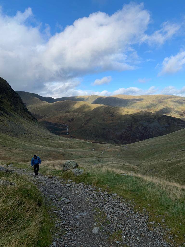
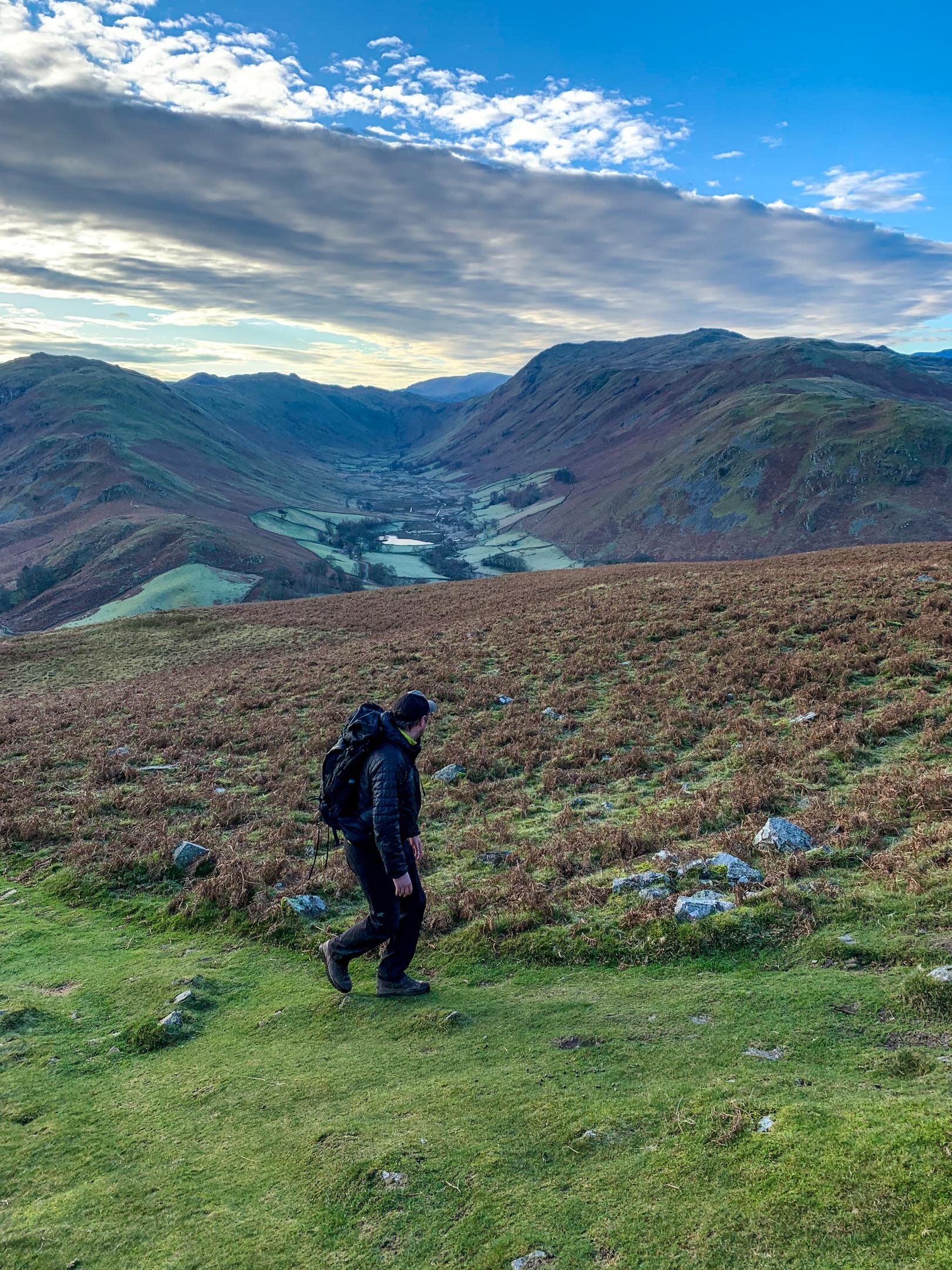
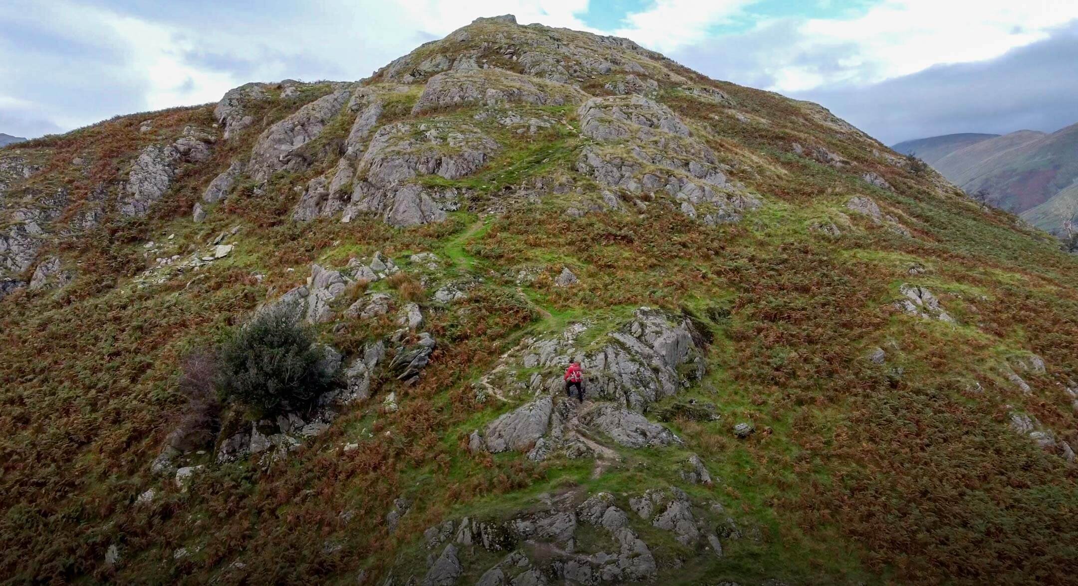
There are two options here, left for the mellow route or right for the direct route up Swarth Fell. The path up Swarth Fell follows a steeper path that zig-zags its way to the top at 504m. From here the hard work is done with 361m of ascent already being gained.
Hallin Fell as seen from Bonscale Pike
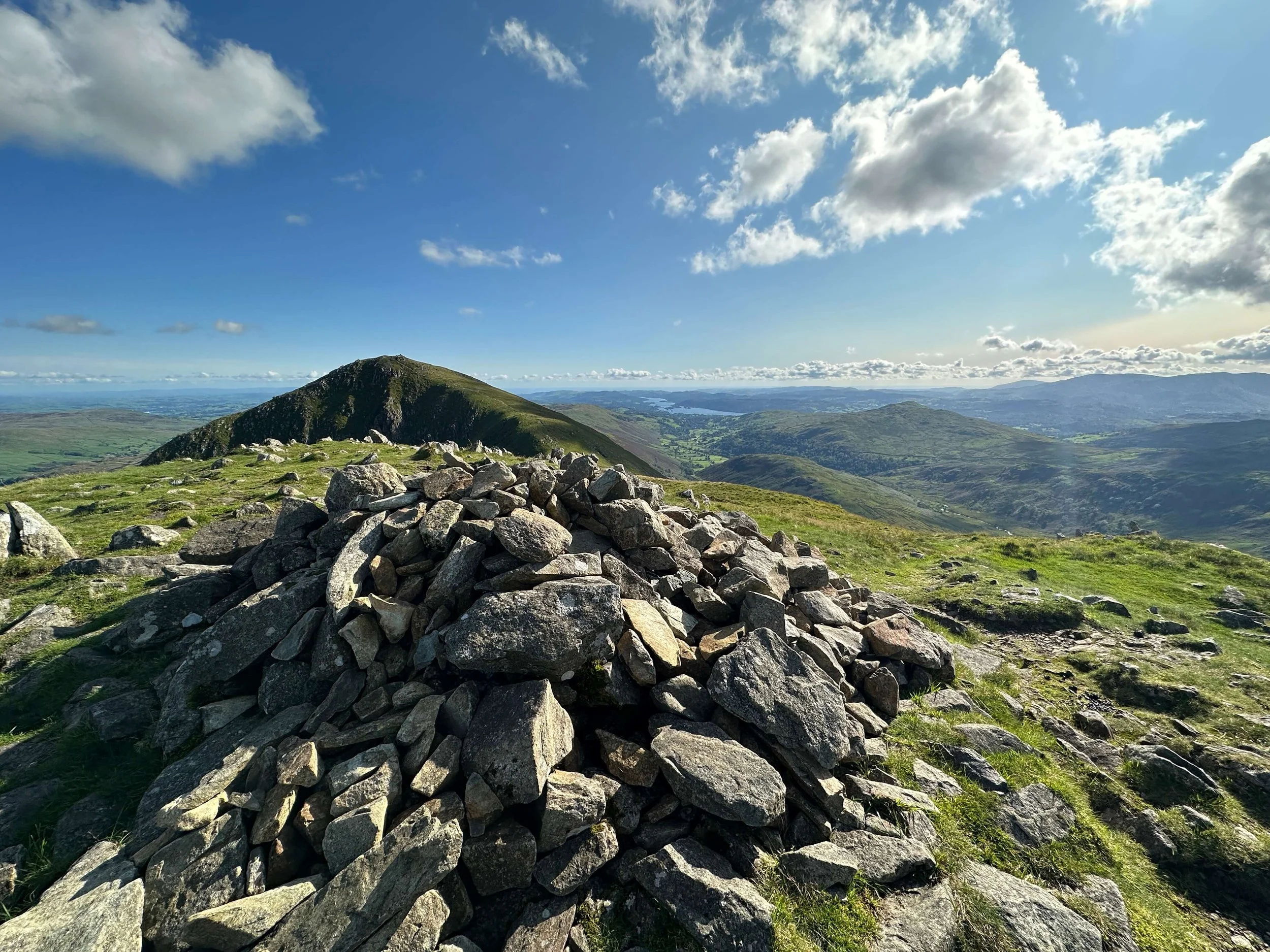
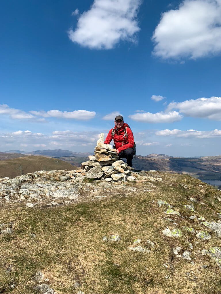
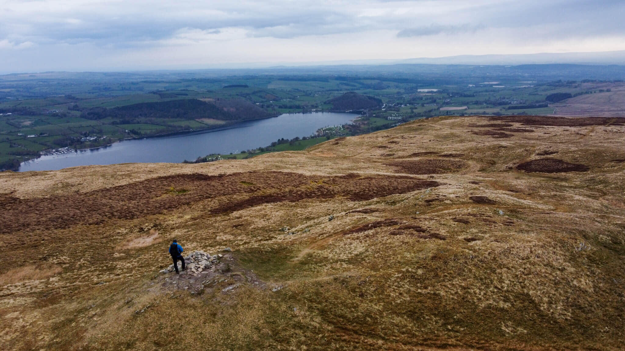
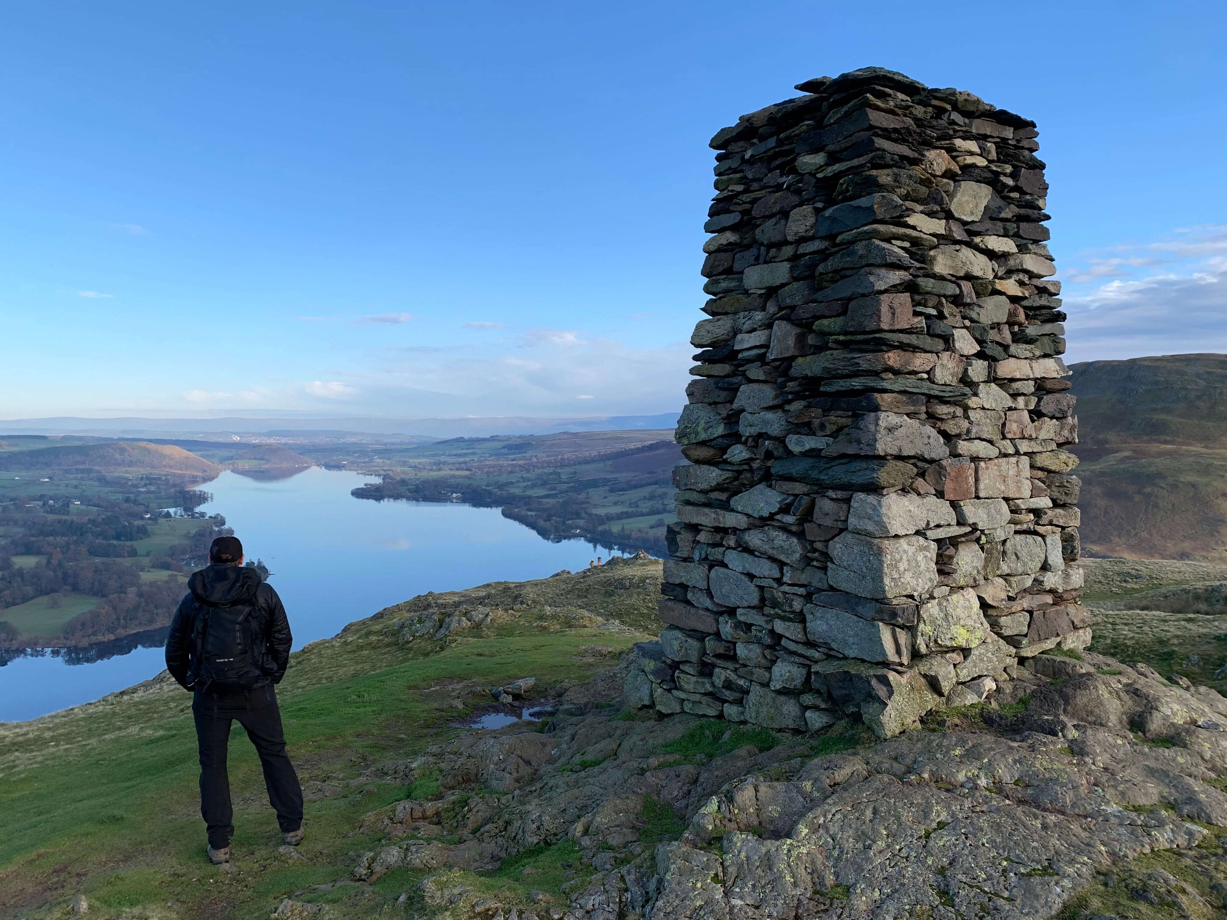
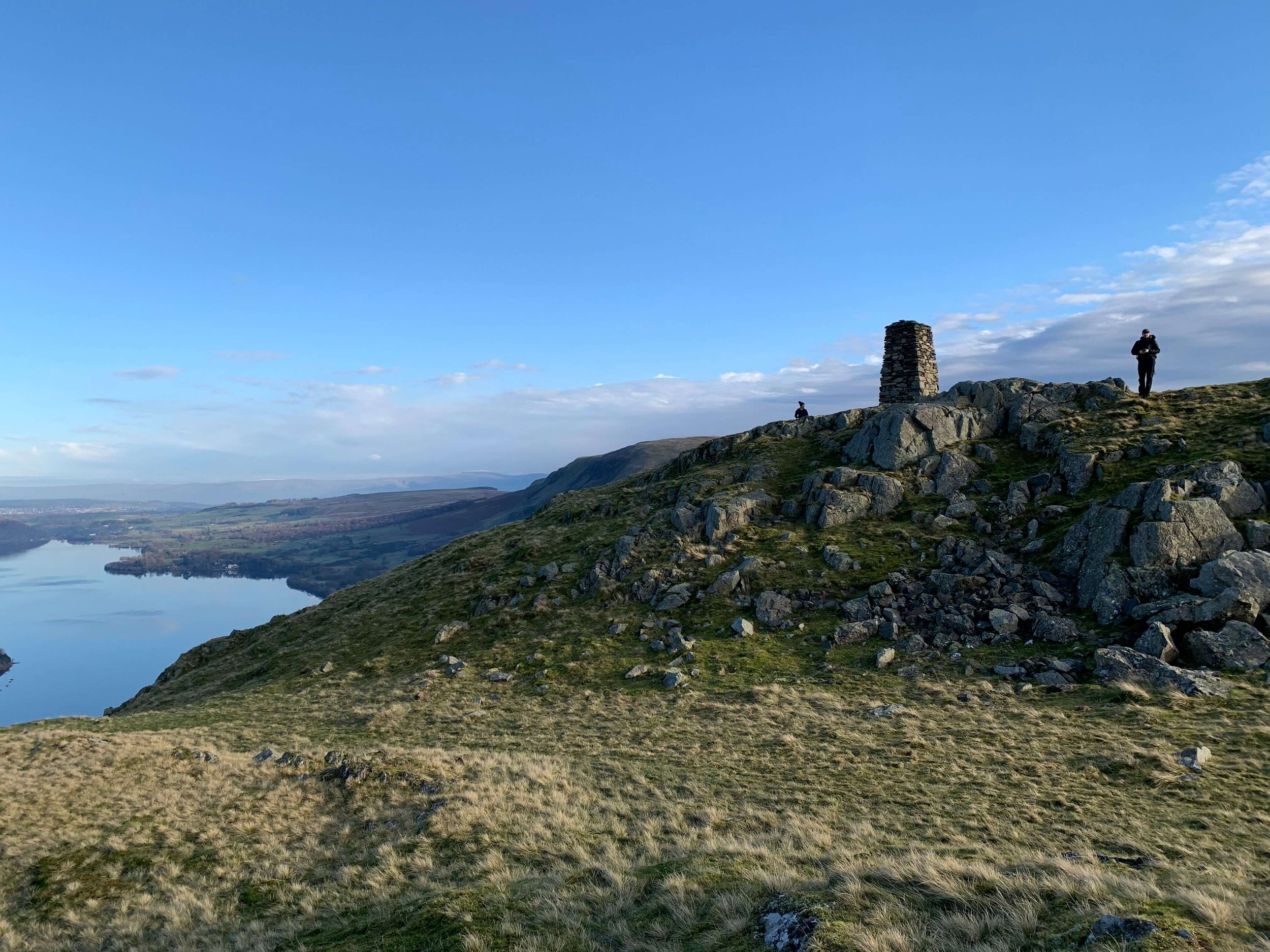
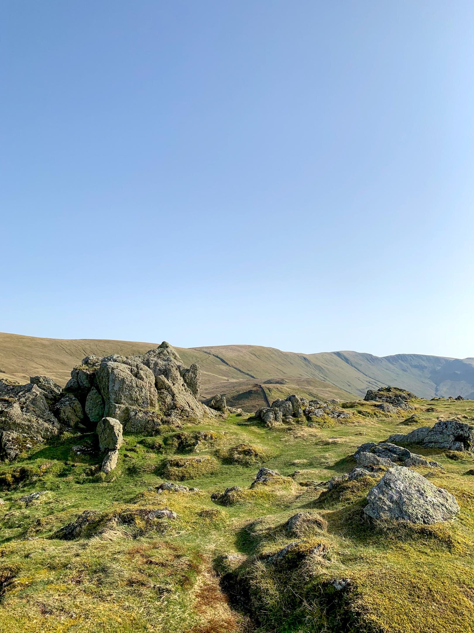
There is a path, not shown on OS maps, that links Swarth Fell and Bonscale Pike with only around 500m of walking between the two summits. The summit of Bonscale Pike is marked with a small Cairn with two towers, Bonscale Towers, slightly further along.
At Bonscale Pike it is worth taking in the views of Ullswater and the surrounding Fells. From here you have a clear view of Hallin Fell which is one of my favourite Lake District Fells.
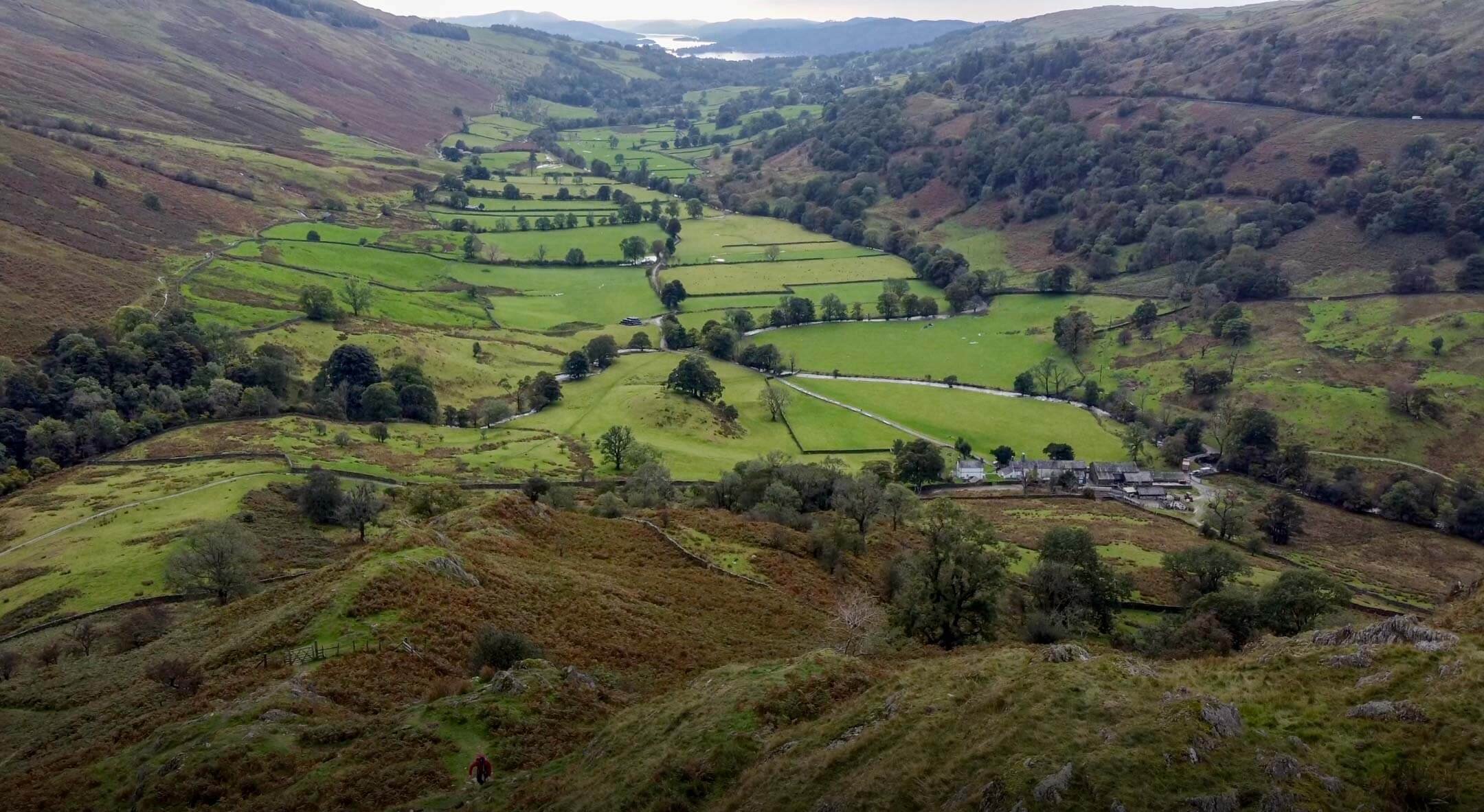
From Bonscale Pike you will need to descend slightly and cross Swarth Beck. You will notice and old stone building that has seen better days, this is an ideal place to cross the waterway and refill any water bottles. Onwards and upwards from here for the final push towards Arthurs Pike.
Arthur’s Pike Cairn
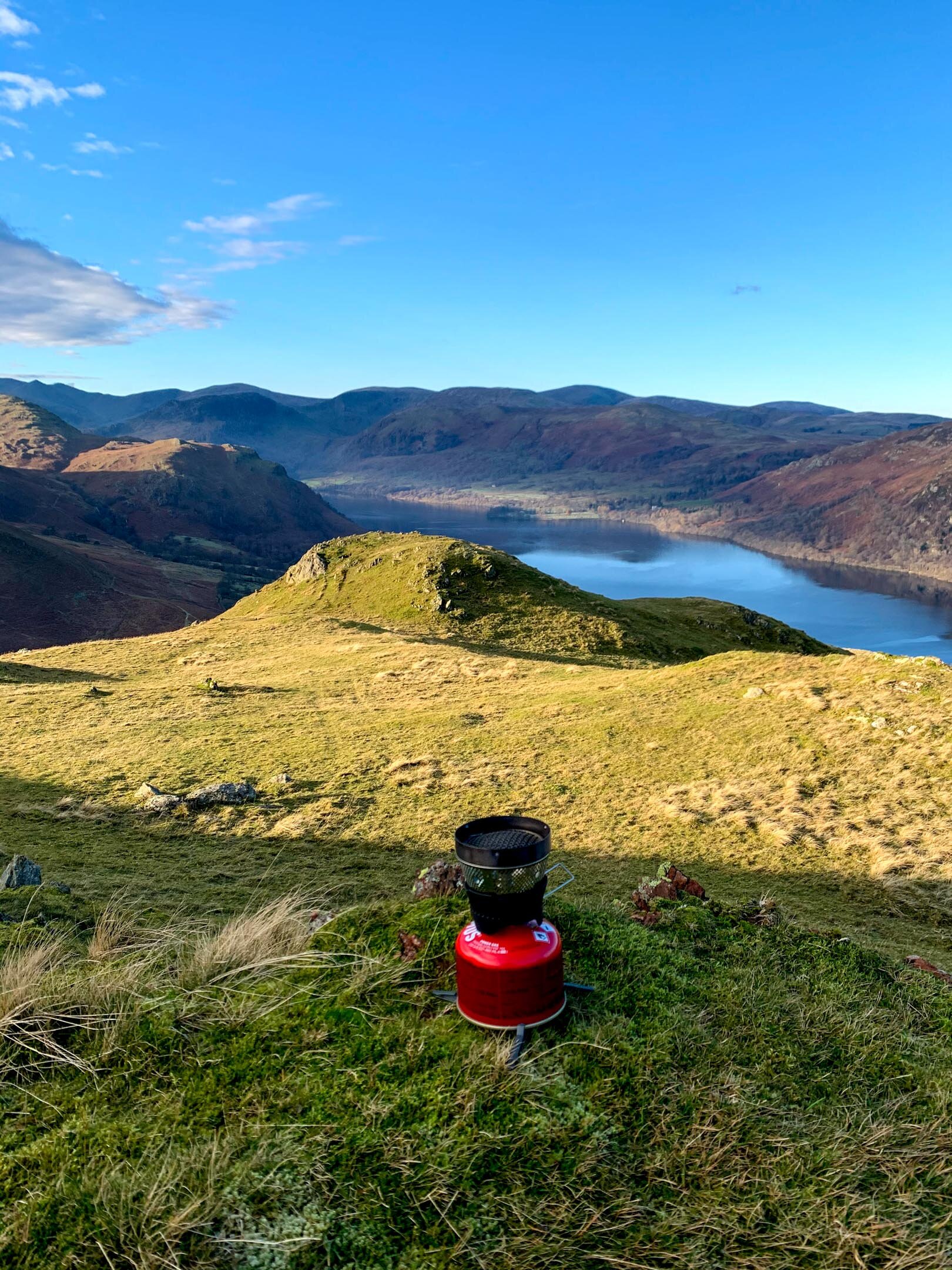
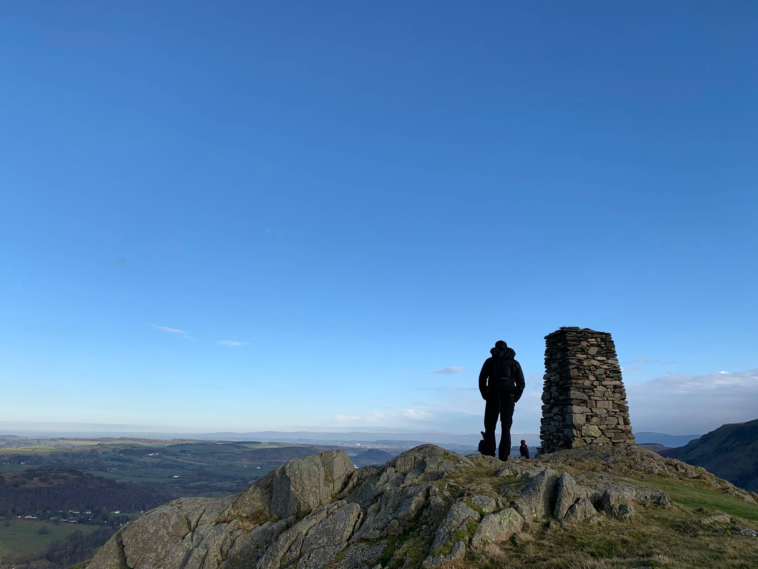
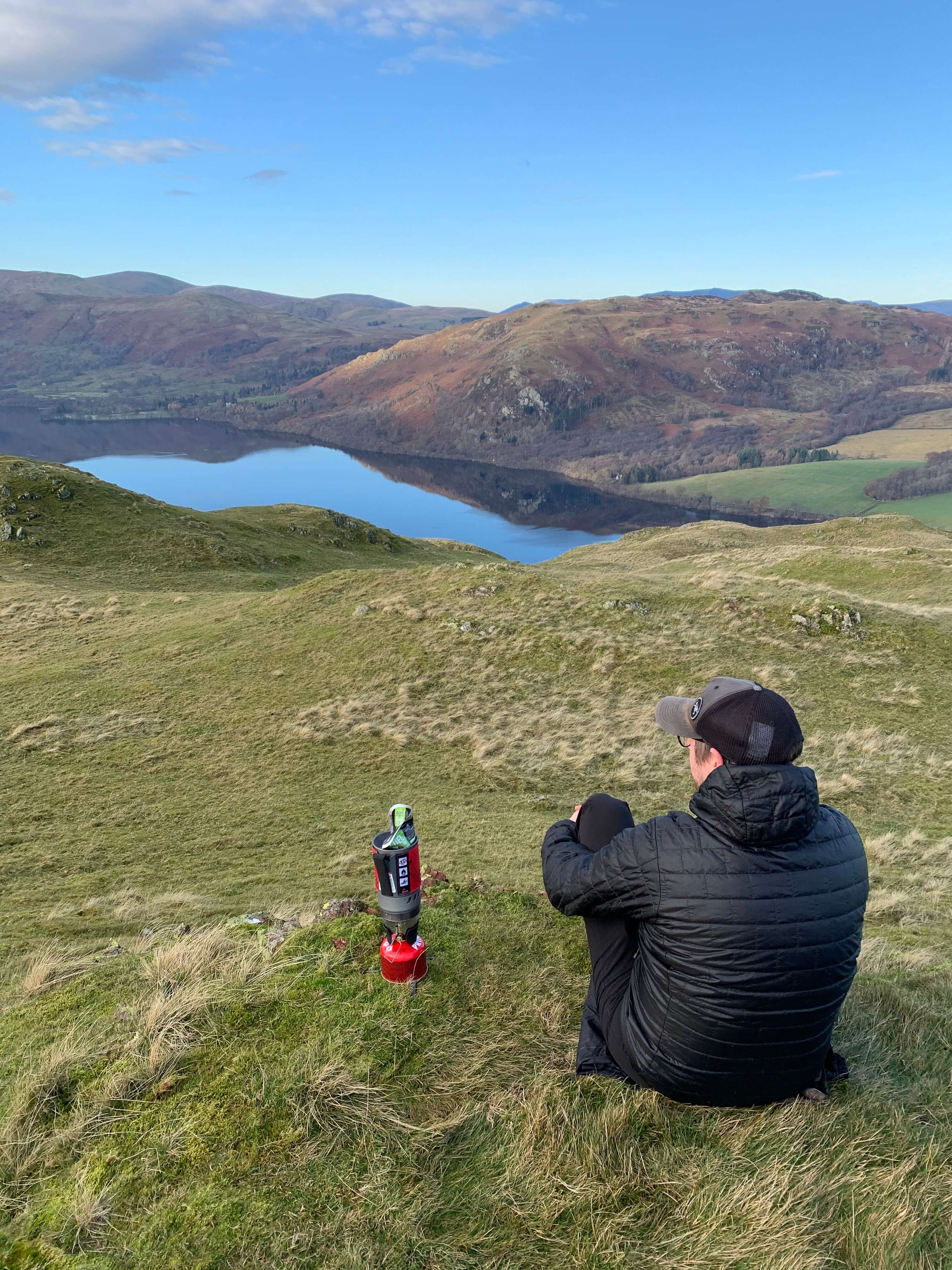
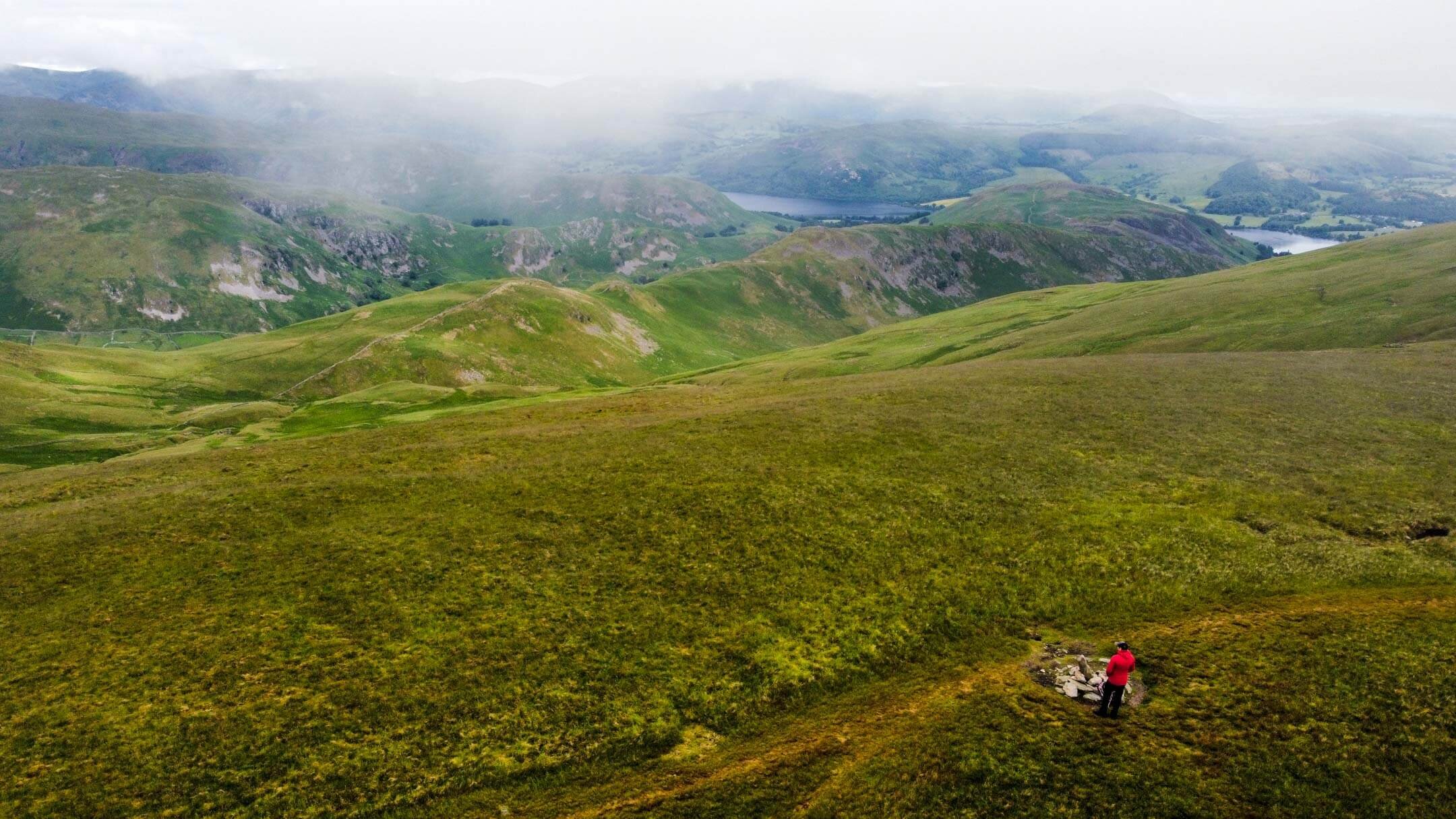
The path from here is well-trodden and clear leading the way to a small cairn that sits atop Arthur’s Pike. Although it is possible to continue your walk from here I would advise finding the larger Cairn atop Whinny Crag as the perfect spot to take in the views. On a clear day, this viewpoint offers unobstructed views of Ullswater Lake and is an ideal place to watch the steamers.
It is this spot that I chose to cook my breakfast and enjoy the views during Episode 3 of #mywainwrightsproject

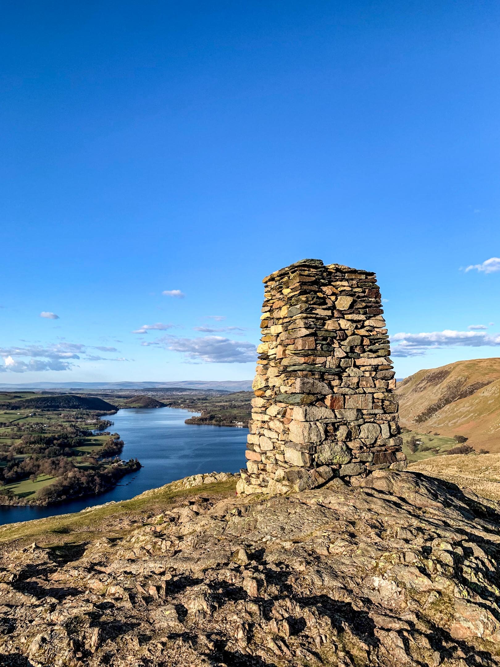
Cairn at Whinny Crag
When you decide it is time to head down from Arthur’s Pike, you will follow the path between Arthur’s Pike and White Knott. The walk down to White Knott is mellow with the path descending 100m over 1.5km of walking.
Similarly to the previous summits, White Knott also has impressive views across Ullswater. The path extends past White Knott before cutting back on itself just before Aik Beck. Keeping Barton Park on your right, follow the path past Ravencragg back towards Howtown.
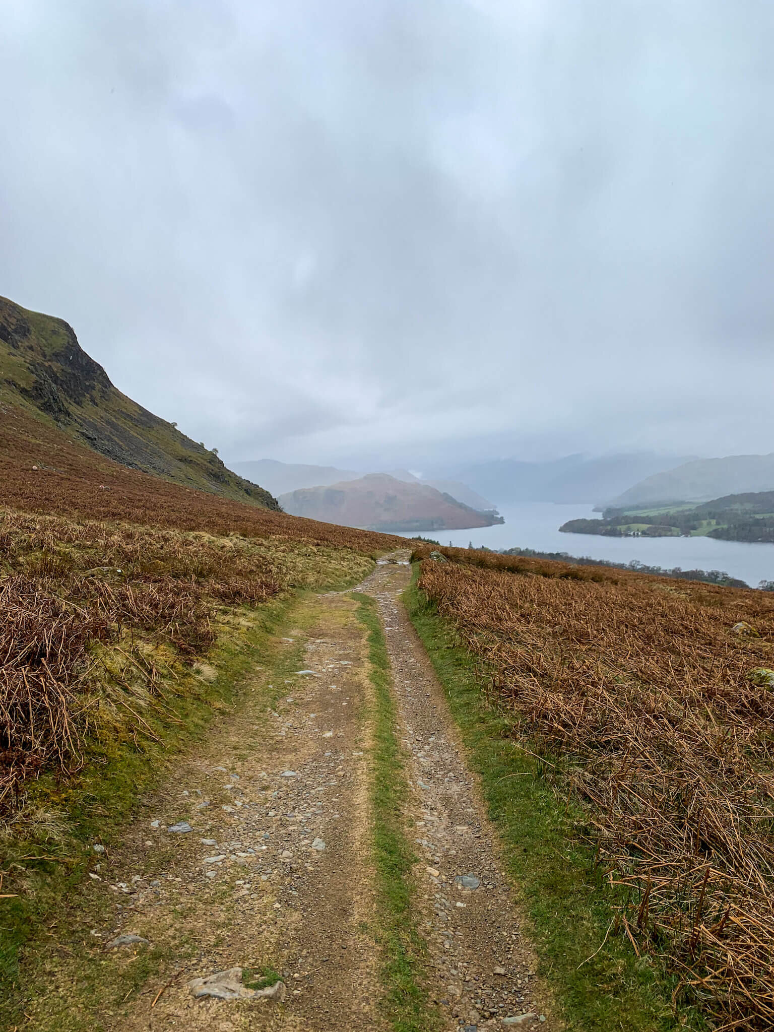
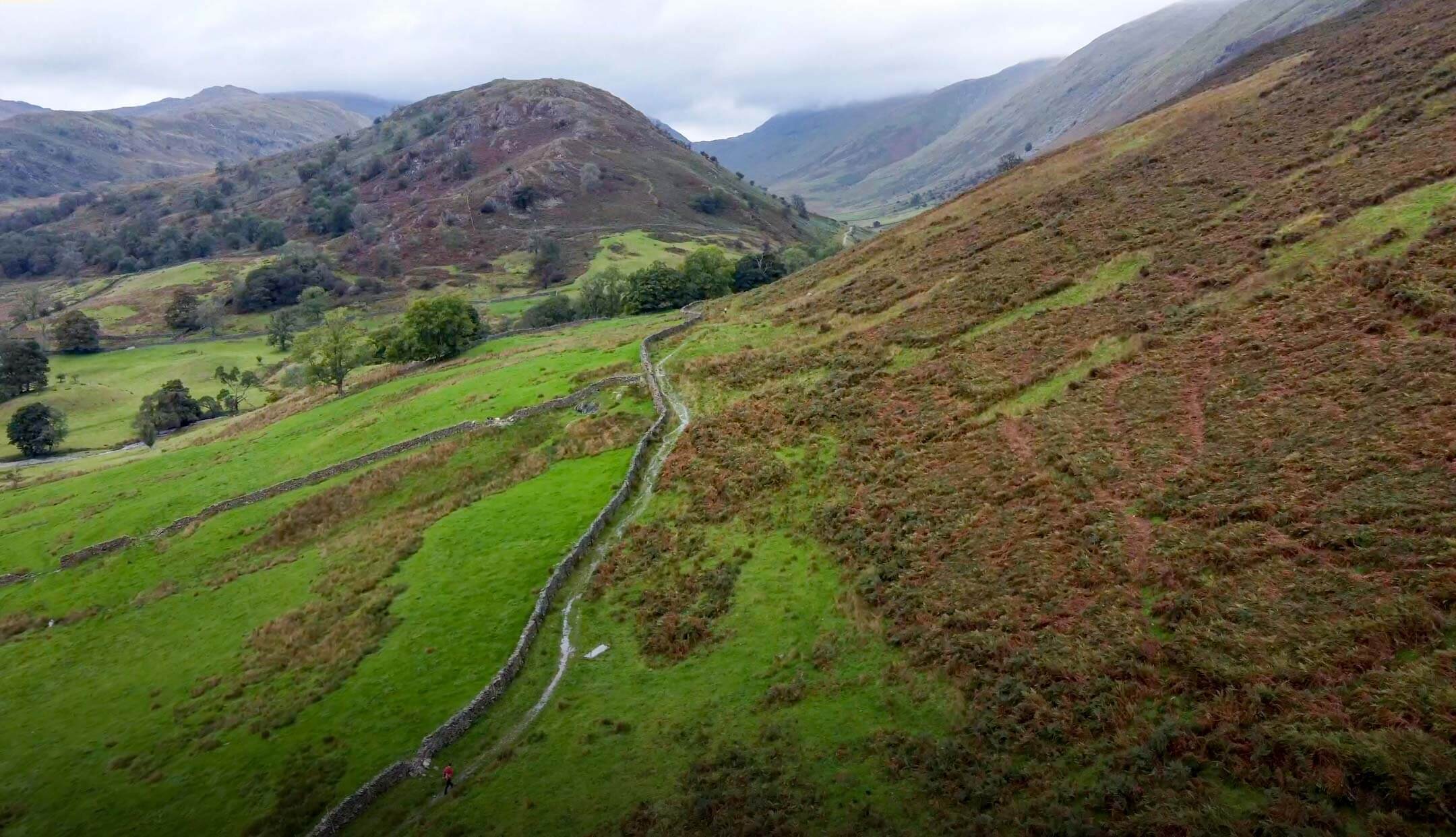
Path back to Howtown
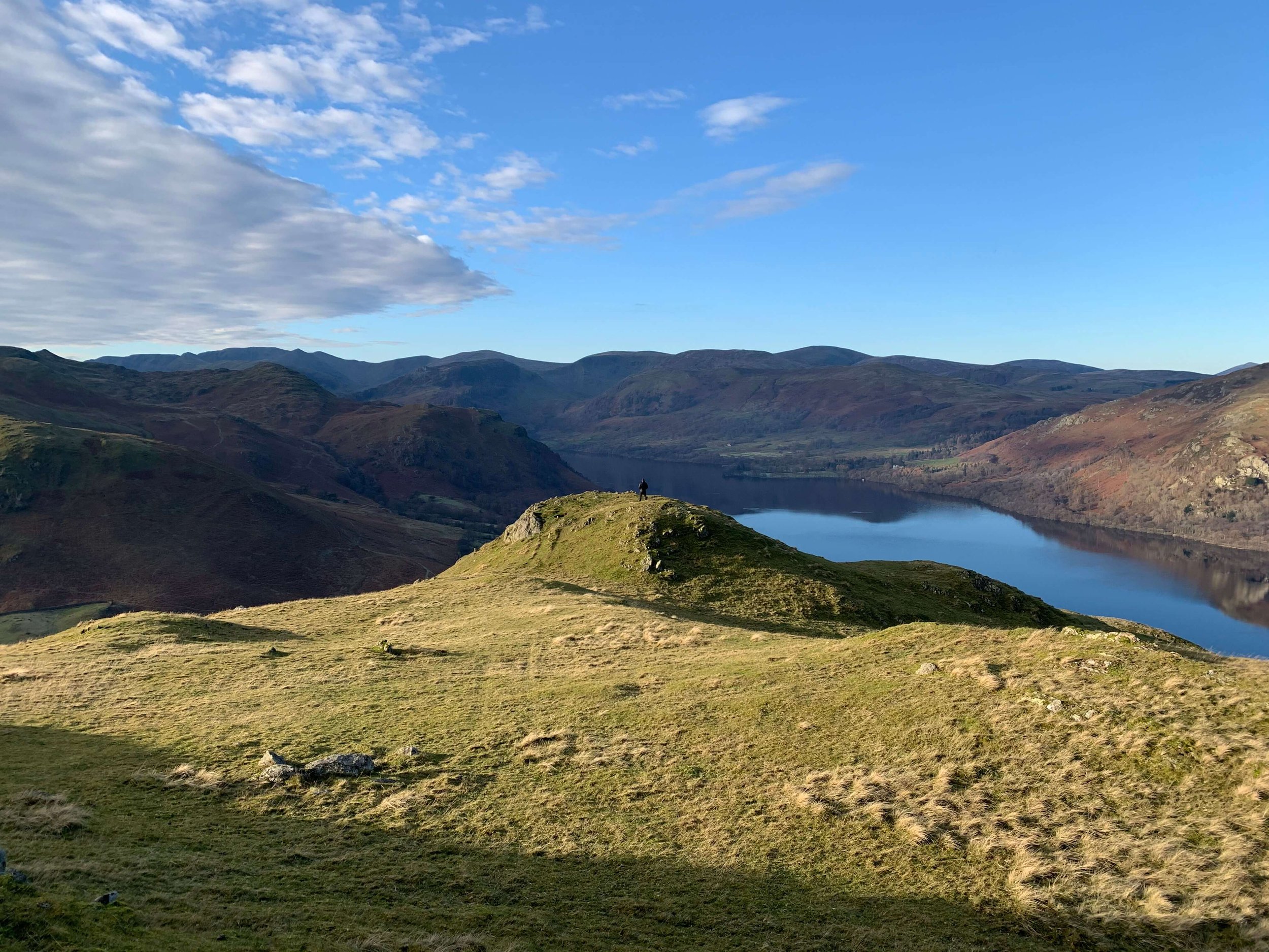
Once atop Swarth Fell this walk offers incredible continuity in the views of Ullswater and the surrounding fells. Although the walk up Swarth Fell can be considered hard work, the rest of this walk is much more mellow. Whether atop; Swarth Fell, Bonscale Pike, Arthur’s Pike or White Knott the views across the Lake stretch from Pooley Bridge to Aira Point, before disappearing behind the prominent Fells.
TOP TIPS FOR WALKING BONSCALE PIKE & ARTHUR’S PIKE
Parking in Howtown can be limited so set off early at peak times. During weekends, evenings and holiday periods Howtown are popular so plan accordingly. With this in mind if you arrive in Howtown and find there is no parking don’t be that person who blocks the road by parking in a passing place!
There are steep sections on this walk so do some forward planning and allow for rest breaks. Hiking poles are a godsend on steeper pitches and can help relieve backspin if carrying a pack.
Pack for a change in weather. This walk should take a moderately fit individual two-three hours. Weather wise a lot can change in that time so consider packing some layers in your backpack.
Having the ability to navigate is essential, especially in incremental weather. You can follow my route on the OS Maps App here on any smartphone.
If you are relying on your phone for navigation, bring a battery pack or a way to charge your device.
Take some lunch with you! There are so many nice spots to stop, eat and enjoy the views.
Thanks for reading this post. If this post provided value for you then you can support me in making future content by using the link to Buymeacoffee Alternatively you can use the tip jar:https://paypal.me/sjburgess87?locale
View back towards Beda Fell
MORE FROM THE FAR EASTERN FELLS


Hallin Fell | Wainwrights Far Eastern Fells
Hallin Fell sits at the eastern edge of Ullswater, a compact but memorable fell that punches well above its modest height. Unlike the more sprawling ridgelines of the Central Fells, Hallin Fell is a distinct, dome-shaped hill whose steep slopes rise sharply from the water and the surrounding lowlands. Its summit offers one of the finest, most concentrated panoramas in the Lake District: a sweeping view down Ullswater with the Helvellyn range forming a dramatic backdrop.
If you’re aiming for a quick, satisfying outing with minimal navigation yet maximum views, Hallin Fell is one of the Lake District’s best short climbs. Below I’ll lay out the essentials so you can decide how to fit it into your day.
Hallin Fell Summit
HALLIN FELL INFORMATION
Hallin Fell is a small but striking fell located on the east side of Ullswater in the Lake District, Cumbria, England. Rising to 388 meters, it sits above the village of Howtown and forms a compact, rounded outcrop that offers surprisingly panoramic views for its modest height. Its distinctive, isolated position at the head of Glenridding gives it a strong visual identity from many vantage points around the lake.
Access and routes
From Howtown: The most common approach starts in Howtown. Follow the path that climbs steadily up the southern slopes; paths are clear but can be steep in places. This route is short — roughly 2–3 miles round trip depending on start point — making Hallin Fell popular for a quick outing.
From Glenridding / Patterdale: You can reach Hallin Fell by following the ridge from the lower slopes above Glenridding or by linking it with a stroll along Ullswater’s eastern shore. Combine it with a lakeside walk for a longer day.
Circular options: A pleasant circular walk can be made by combining the Howtown ascent with a descent toward Patterdale or back along the lakeshore, giving varied views of Ullswater. Equally my chosen route combined the fell tops of Hallin Fell and Steel Knotts.
Terrain and difficulty
Terrain is mostly grassy with some rocky sections near the summit. Paths are well-trodden but can be muddy after rain.
The climb is relatively short and suitable for walkers of moderate fitness. No technical scrambling is required. Good footwear and basic hill navigation skills are recommended, especially in low cloud.
Views and features
The summit offers one of the most famous and rewarding short-walk viewpoints in the Lakes: you get a clear, elevated view down the length of Ullswater, with Helvellyn and the high fells forming the distant backdrop.
The fell’s shape creates a natural amphitheater effect looking over Howtown and the north-eastern end of the lake.
Birdlife and sheep are common; spring and summer bring wildflowers on the slopes.
Practical considerations
Parking: Limited parking is available in Howtown and nearby laybys; Glenridding has larger parking and better transport links. Parking also available in Martindale, but can fill up fast on busy summer days.
Transport: Hallin Fell is accessible by road and by seasonal passenger boats on Ullswater that call at Howtown, which can make for a scenic arrival or return leg.
Facilities: There are no facilities on the fell itself. Pubs, cafes, and accommodation are available in Glenridding, Patterdale, and Pooley Bridge.
Best times: The fell is enjoyable year-round. For fewer crowds, visit early morning or shoulder seasons.
Hallin Fell is ideal if you want a short, accessible walk that delivers classic Lake District views without a long, strenuous ascent. Its compact route, dramatic outlook over Ullswater, and easy combination with lakeside walks or boat trips make it a great choice for families, day-trippers, and those working in a mixed itinerary of hiking and sightseeing.
HEIGHT IN METRES 388m
HEIGHT IN FEET 1273ft
RANGE Far Eastern Fells
GRID REFERENCE NY 433198
Have you walked Hallin Fell? Let me know what you thought of the views below.
HALLIN FELL VIDEO
WHERE IS HALLIN FELL ?
From Penrith follow the A66 eastbound to the turn for Pooley Bridge, then take the B5320 into the village; parking is available by the bridge and at the public car park if you are taking the Ullswater Steamer to Howtown. If driving to Martindale, there is a narrow road that winds its way around the banks of Ullswater, past Parkfoot holiday camp and onwards to Howtown. Be sure to take note of the last passing place as its not uncommon to need to reverse back to let other cars pass. Once in Howtown, you can take the winding road up to Martindale where parking is possible by the church.
HALLIN FELL GALLERY


RELATED POSTS


HALLIN FELL AND STEEL KNOTTS CIRCULAR ROUTE | WAINWRIGHT WALKS
If you are looking for a short walk that offers exceptional views, it really is hard to beat Hallin Fell. In Wainwright’s own words Hallin Fell is “beautifully situated overlooking a curve of Ullswater and commanding unrivalled views“. Combining Hallin Fell with Steel Knotts makes for a beautiful circular walk that takes in some of the best views in the Far Eastern Fells.
View of Hallin Fell Obelisk looking back towards Pooley Bridge
This Hallin Fell and Steel Knotts walk ensures scenic views of lakes, valleys and distant peaks whilst ticking two Wainwrights of your list.
This post covers the route that I took to climb Hallin Fell and Steel Knotts, however as with all outdoor activities caution should be taken and you should ensure you have the correct equipment, knowledge and understanding to complete your walk. With this in mind, other routes are available and may be more suitable, so proceed with caution. An example being my route up Birkie Knotts was the most direct route. Other more subtle paths are available and should be considered.
That being said, this route is popular amongst Lake District walkers as it is fairly simple, short, but offers substantial rewards in regards to the views.
WALK OVERVIEW
Start - Howtown Pier
Parking is available at Howtown Pier on the road side. Be sure not to park in the passing places as these are vital to ensure traffic can flow. If the roadside parking is full or you fancy a shorter walk, you can also park at the Church in Martindale. (UPDATE- Very little roadside parking is available by the peer. Parking at Martindale or the Howtown Hotel, if a guest, is best)
Tip - Park in Pooley Bridge and take the Ullswater Steamer to Howtown. The lake crossing certainly adds something special to any Howtown adventure.
Distance - 7.2km / 4.5 miles
You can reduce this by parking in Martindale, however, the stroll past Ullswater and Howtown Pier is nice and that’s why I included it in my walk.
Duration - 2hr 40 - 4 hr
Depending on fitness levels and how often you are stopping to take photos of the stunning Ullswater.
Difficulty - Moderate
It is hard to justify difficulty for me as everyone’s boundaries are different. That being said this walk is very achievable to the majority of people. You can ensure the route is easier by taking a more subtle path up Birkie Knotts which could be quite steep to some.
Total Ascent - 512m
Map - You can find my full route here on Ordance Surveys website
PREPARING FOR YOUR HALLIN FELL & STEEL KNOTTS WALK
NAVIGATION
As with all good walk preparation you will need a way to navigate on your walk. I use the OS Maps App on my phone and you can find my route here
If you are navigating using your phone be sure to do the following;
Download the map before you leave wifi - you CANT guarantee you will have signal in the mountains.
Bring a battery pack or way to charge your device.
Print a copy of the walk before you leave from the Ordance Survey Website as a back up.
I also use my Suunto Watch as a backup navigation tool, however if you are not confident that your technology will last you should purchase the Ordnance Survey Map for your walk.
WEATHER
If there is one thing that is for certain when walking in British Mountains is that you can never be sure of the weather. Even on days that are forecast glorious sunshine it is best to be prepared for the worst, as conditions can change rapidly.
Check the latest Hallin Fell weather here
WHAT TO WEAR
When hiking in the UK it is important to remain flexible and with this in mind layers are certainly your best option. Mountain environments can be unforgiving and weather can change quickly. It is normal to see winds increasing and temperatures dropping as you reach your chosen summit. Make sure to pack a spare layer for the summit.
Suitable footwear in the form of walking boots or shoes is advised, especially when conditions are less than ideal. A good pair of walking boots will offer your ankles support, keep your feet dry and ensure you have grip especially on those wet days. Yes, you probably could make it to the top in that old pair of tennis trainers… but will your feet thank you?
WHERE TO START
Getting to the start of the walk involves driving down some narrow country roads towards Howtown and Martindale from Pooley Bridge. Be careful as traffic can be busy at peak times and there are few places to pass. It is important to keep an eye out for the last passing place as it is not uncommon for you to need to reverse back down the road.
The postcode for Howtown if you are using your Sat Nav is CA10 2LZ and this should lead you to the Howtown Pier. Parking is possible by the Pier on the roadside but this is limited.
If you fancy a cool alternative to access Howtown consider taking a trip on the Ullswater steamers.
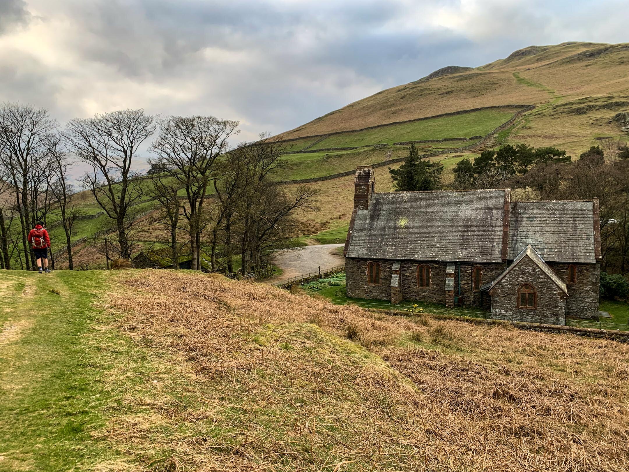
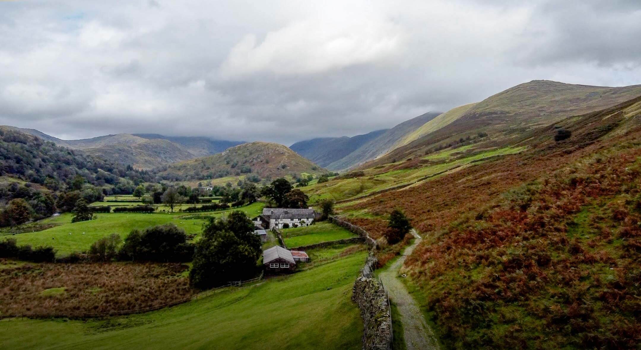
Church in Martindale that sits between Hallin Fell and Steel Knotts
Parking is also possible by St Peter’s Church in Martindale. The church sits at the base of the paths to Hallin Fell and Steel Knotts so is ideally located. This area can become busy so be sure to head up early or late to guarantee a parking spot.
Parking in both Howtown and Martindale is free but be sure to be considerate of other road users. The road is used by farm vehicles and blocking it could result in your car getting ‘bumped’ by a tractor.
FACILITIES
Unlike more popular areas of the Lake like Keswick and Windermere there are no facilities in Howtown and Martindale. To me this is a positive as it draws less people but it is worth noting you should be prepared for a wild wee if you get caught short.
HOWTOWN PIER TO HALLIN FELL VIA STEEL KNOTTS ROUTE
Starting your walk from Howtown Pier is nice as it means you begin your walk at water level with a scenic stroll along the edge of the lake. Parking by the pier in Howtown can be tough to come by during peak times. Consider setting of early to ensure a parking space. Alternatively, use the Ullswater Steamers boats from Pooley Bridge to drop you in Howtown. You can find the timetable here.
Taking the footpath along the Lake leads to a set of narrow steps that lead you onto the base of Hallin Fell. Taking a right at the top of the steps leads you on a beautiful walk around the base of Hallin Fell, but I will save that for another day. Turn left and follow the path up towards Martindale. The path overlooks a winding road that leads to Martindale and the path meets the road at the top by St Peter’s Church.
When you reach the Church of St Peter in Martindale it is likely you will see cars parks along the road. This is an alternative starting point to your walk.
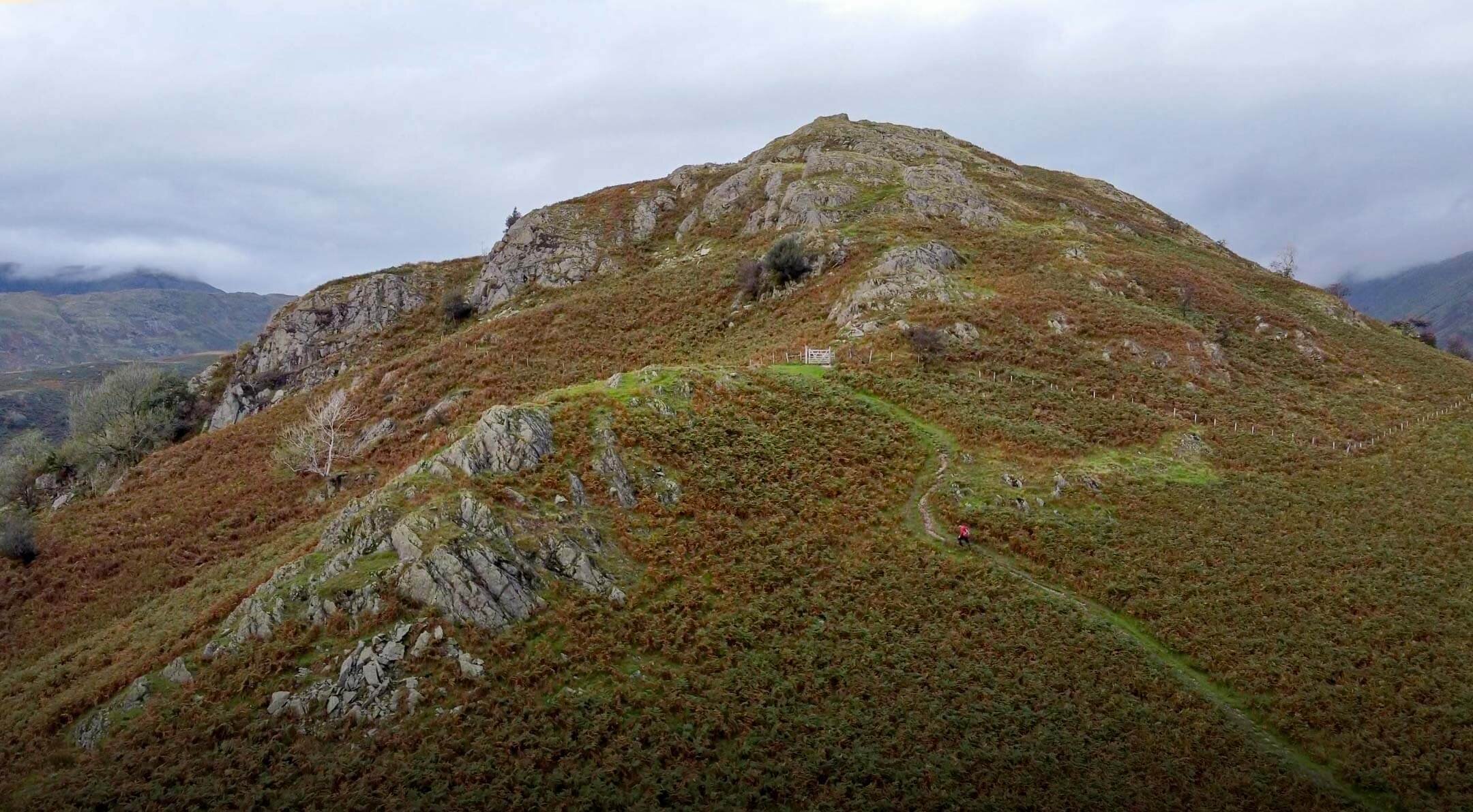
Wherever you choose to start your walk you will need to follow the footpath behind the Church towards Birkie Knott. The path up Birkie Knotts is steep but well trodden with a clear footpath to follow. I prefer taking the steeper route up, however if you prefer, it is possible to take a more mellow route to the right of Birkie Knott.
A brief stop at the top of Birkie Knott will be well deserved and rewarding with views looking back towards Pooley Bridge and Dunmallard Hill. This is also a pretty decent spot to watch the steamers pulling into Howtown.
Steel Knotts Pikeawassa Summit
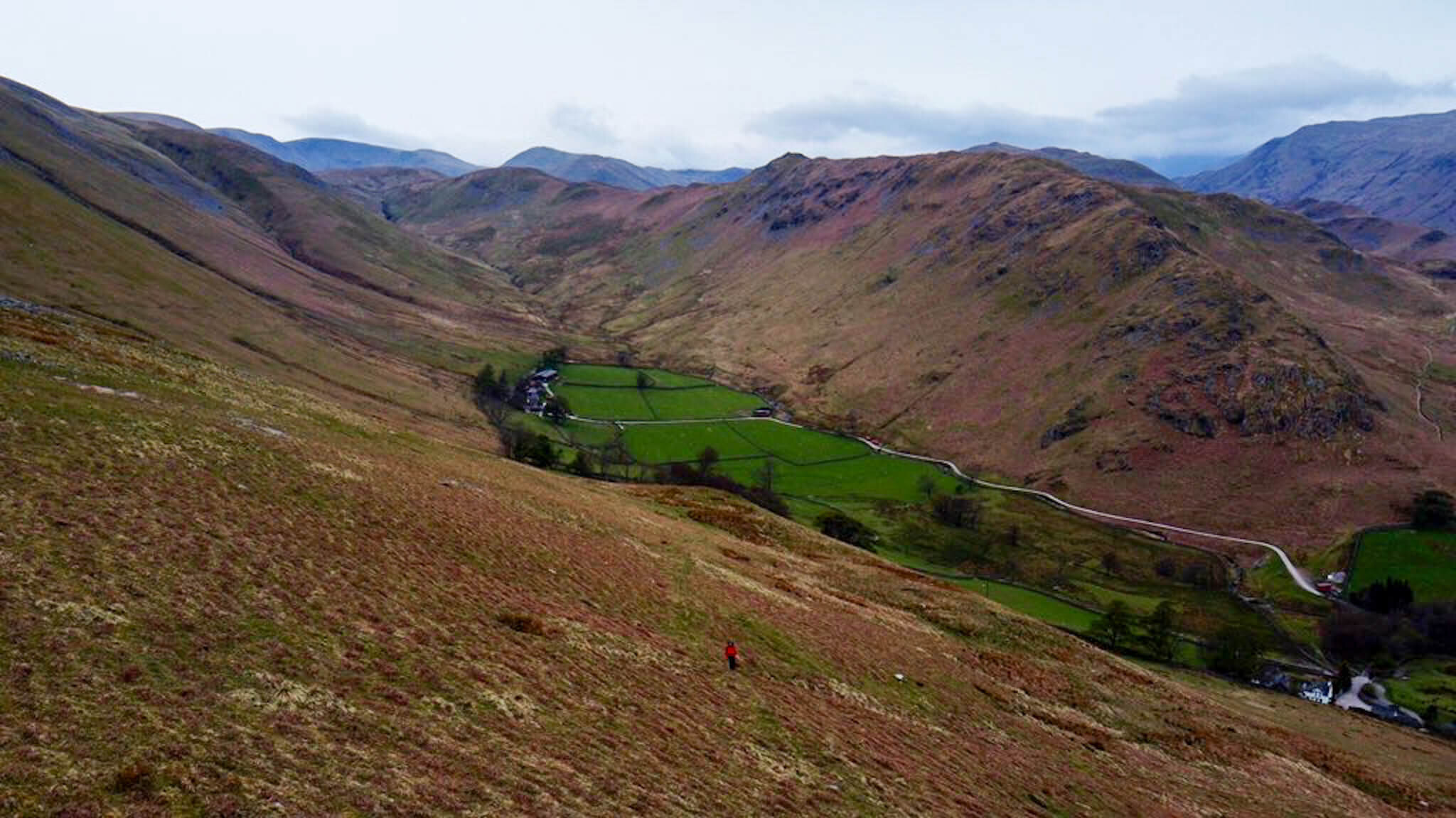
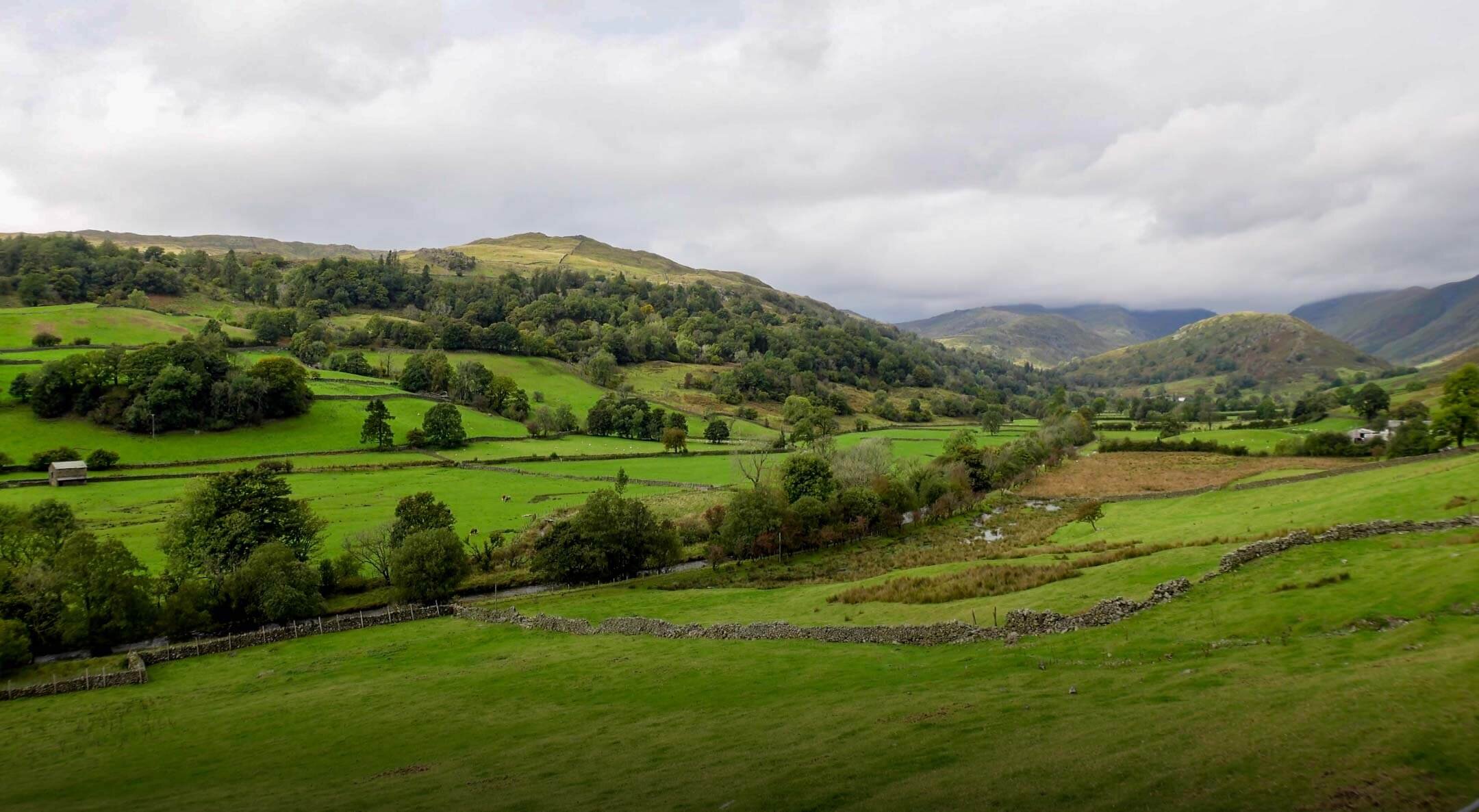
Continue onwards towards Steel Knotts along the mellow but winding path that runs along the ridge. The rocky ridge of Steel Knotts is unmistakable with a imposing summit name Pikeawassa. The ridge itself is around two miles in length and overlooks the steep valley of Fusedale. On a clear day you will be able to take in some beautiful views of the Martindale Horseshoe and the Helvellyn range from Pikeawassa. At 432m, Steel Knotts Pikeawassa is achievable for many and has to this point been one of my favourite Lake District summits.
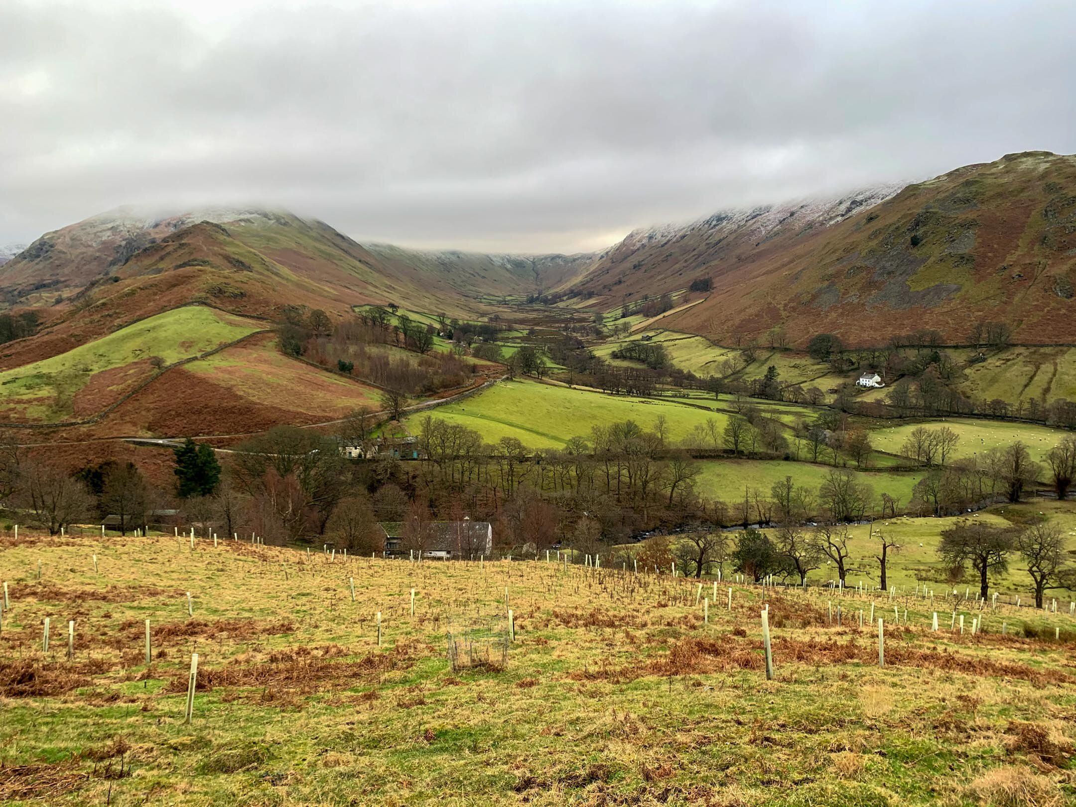
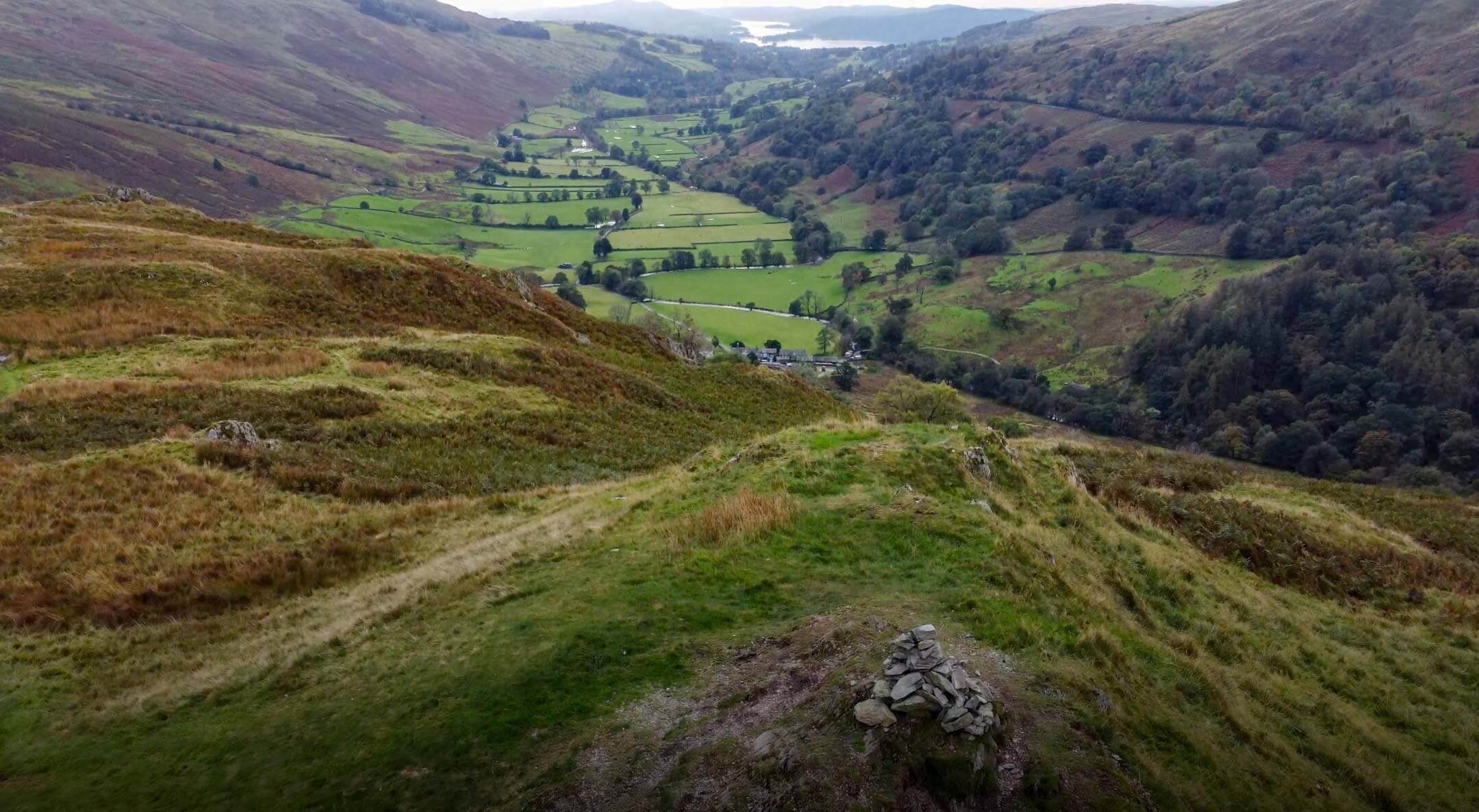
To continue onwards to Hallin Fell take the path towards Brownthwaite Crag before meeting a stone wall. From the wall you will be able to see a path that loops back towards the church at Martindale. Running above Nettlehowe Crag, with some uninterrupted views of Beda Fell on the opposite side of the valley, this path is a really enjoyable aspect of this walk.
As mentioned, this path will lead you back to the church at Martindale and all you have to do is cross the road onto Hallin Fell. There are various paths up Hallin Fell with the most popular potentially being one of the steepest. You will see the wide, well trodden path leading its way up Hallin Fell and your only job is to follow it.
As seen from Hallin Fell
When walking the path up it is essential to take time to turn around and look at the scenery behind you. The views back towards the Martindale Horseshoe are impressive, letting your mind run away with the many possibilities of walking routes in the area. It was on this part of the walk that I decided to make Beda Fell Episode 2 in #mywainwrightsproject
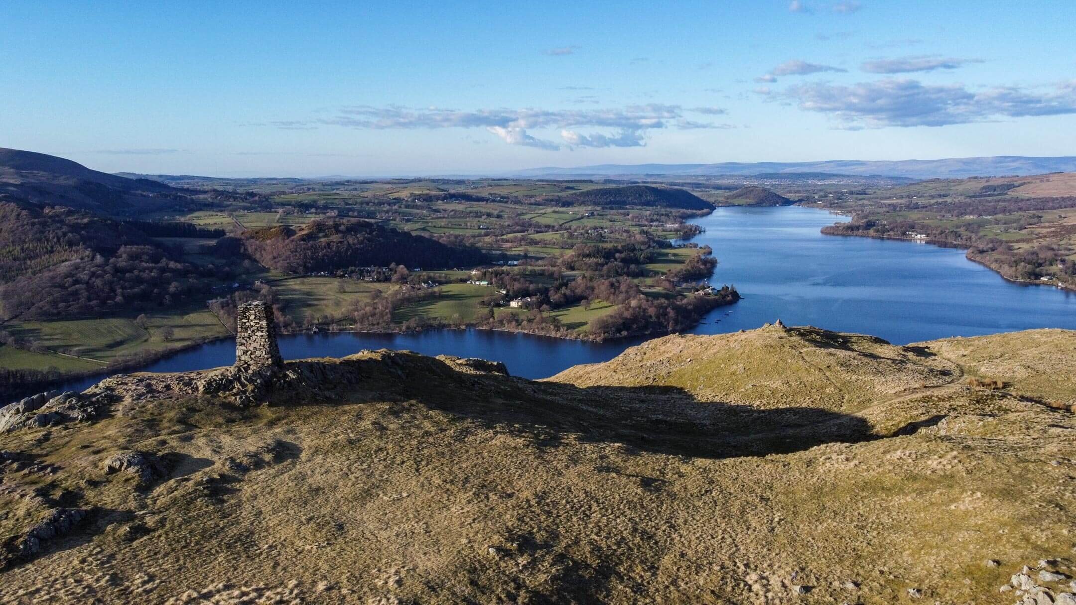
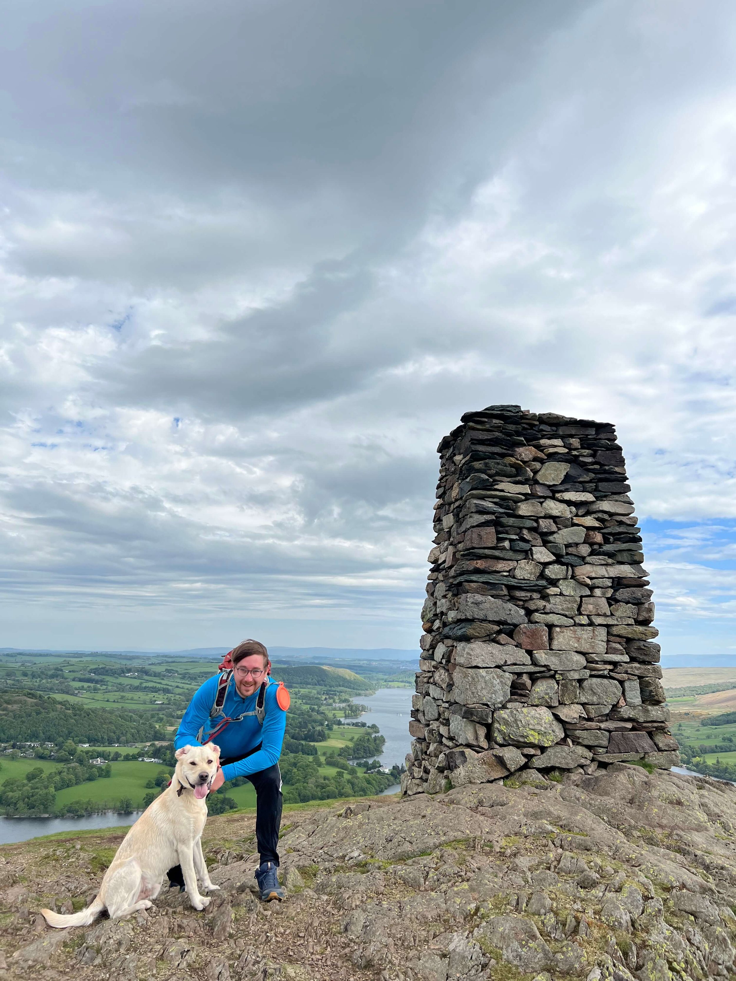
One of the most impressive parts of this route up Hallin Fell is just how well the path hides the views of Ullswater until, at the last minute, revealing stunning views of the lake on three sides of the fell. As you round the final bend at the top of the path the Obelisk reveals itself and it is hard not to feel blown away, and not by the Cumbrian wind. The views from Hallin Fell rival many places in the world where hills and mountains meet lakes or water. And it is this, combined with the simplicity of the walk, that makes Hallin Fell popular with walkers from all over the UK.
Incredible views from atop Hallin Fell
After you have filled your camera roll with the many epic panoramas visible from atop Hallin Fell it is time to descend. Again you have options here, however a personal favourite of mine is the steep route to the east leading back to Waternook. This route should be avoided in adverse whether as the gradient can make it difficult to maintain footing. In fair weather or for those experienced and prepared this pathway drops away towards the banks of the lake allowing the scenery to open up around you. It is from this descent that you will find your way back onto the original path leading to the staircase and Howtown.

Path back down Hallin Fell looking back towards Pooley Bridge and Dunmallard Hill
TOP TIPS FOR WALKING STEEL KNOTTS AND HALLIN FELL
Whether you are planning to park in Howtown or Martindale be prepared to set off early at peak times. During weekends, evenings and holiday periods Martindale and Howtown are popular so plan accordingly. With this in mind if you arrive in Howtown or Martindale and find there is no parking don’t be that person who blocks the road by parking in a passing place!
There are steep sections on this walk so do some forward planning and allow for rest breaks. Hiking poles are a godsend on steeper pitches and can help relieve backspin if carrying a pack.
Pack for a change in weather. This walk should take a moderately fit individual a two-three hours. Weather wise a lot can change in that time so consider packing some layers in your backpack.
The paths are fairly clear but bring some navigation to help you if adverse weather should arise. You can follow my route on the OS Maps App here.
If you are relying on your phone for navigation, bring a battery pack or a way to charge your device.
Take some lunch with you! There are so many nice spots to stop, eat and enjoy the views.

Preparing for breakfast on Hallin Fell
Are you planning a Steel Knotts & Hallin Fell Walk? Feel Free to ask me any questions in the comments!
Thanks for reading this post. If this post provided value for you then you can support me in making future content by using the link to Buymeacoffee. Alternatively, you can use the tip jar:https://paypal.me/sjburgess87?locale

Views from atop Steel Knotts
Angletarn Pikes | Wainwrights Far Eastern Fells
ANGLETARN PIKES
Angletarn Pikes is a captivating fell, known for its distinctive twin peaks and the picturesque Angle Tarn nestled between them. The ascent to Angletarn Pikes is moderately challenging, making it accessible for most hikers while still offering a sense of accomplishment. The route typically starts from Patterdale, winding through lush valleys and ascending gradually to the tarn. Once you reach Angle Tarn, the landscape unfolds with stunning beauty—a tranquil body of water surrounded by rugged peaks. From there, a climb to the summit reveals panoramic views of the surrounding fells and valleys, making the effort well worth it. The twin peaks provide unique vantage points, each offering different perspectives of the Lake District. Angletarn Pikes embodies the essence of fell walking in the Far Eastern Fells, combining natural beauty with a rewarding hiking experience. It's a must-visit for anyone looking to explore Wainwright's routes in the Lake District.
ANGLETARN PIKES INFORMATION
HEIGHT IN METRES 567m
HEIGHT IN FEET 1860ft
RANGE Far Eastern Fells
GRID REFERENCE NY 413148
Have you walked Angletarn Pikes? Let me know what you thought of the views below.
ANGLETARN GALLERY


ANGLETARN PIKES RELATED POSTS
WAINWRIGHT’S GUIDES

ANGLETARN PIKES MAP
Troutbeck Tongue | Wainwrights Far Eastern Fells
TROUTBECK TONGUE
It would be fairly easy for Troutbeck Tongue to go unnoticed. Set in the Troutbeck valley surrounded by larger fells part of the appeal of Troutbeck Tongue is its anonymity. One of many Tongues in Lakeland, Troutbeck Tongue is a wedge of sharply rising ground shouldered by a beck that runs along its base. Raising from the valley floor at Dalehead, Troutbeck Tongue is modest in size but with views back towards Windermere and the lakes it should not be overlooked. Whether gazing at Troutbeck Tongue from the nearby Kirkstone Pass or undertaking the mellow walk, Troutbeck Tongue is sure not to disappoint. Accessible from the village of Troutbeck or via longer walks from nearby Ambleside or Windermere there are plenty of options for Troutbeck Tongue walks.
TROUTBECK TONGUE INFORMATION
HEIGHT IN METRES 364m
HEIGHT IN FEET 1194ft
RANGE Far Eastern Fells
GRID REFERENCE NY 422064
Have you walked Troutbeck Tongue? Let me know what you thought of the views below.
TROUTBECK TONGUE GALLERY
TROUTBECK TONGUE RELATED POSTS
APPROPIATE MAP


WAINWRIGHT’S GUIDES

TROUTBECK TONGUE MAP
Place Fell | Wainwrights Far Eastern Fells
Place Fell
Place fell sits uncompromisingly across from Glenridding with its summit offering incredible panoramas across Ullswater. Accessible from Martindale or more popularly Patterdale, walking Place Fell can be done via a variety of routes. The views from Place Fell are amongst the best in the Far Eastern Fells with unobstructed views across Helvellyn and High Street.

Place Fell Summit
Place Fell Summit is 657 metres high and is a Fell in the Far Eastern Fells. Out of the 35 Fells listed by Wainwright in the Far Eastern Fells Place Fell has to be amongst the most stunning. Regardless of your approach, you are bound to be wowed by this scenic fell.
Place Fell Information
HEIGHT IN METRES 657m
HEIGHT IN FEET 2156ft
RANGE Far Eastern Fells
GRID REFERENCE NY 405169
Have you walked Place Fell? Let me know below which route you took.
Place Fell Related Posts
APPROPIATE MAP

WAINWRIGHT’S GUIDES
Place Fell Video
Place Fell Map
Place Fell Gallery
PIN THIS POST
Far Eastern Fells Posts
Wether Hill | Wainwright's Far Eastern Fells
Wether Hill
Wether Hill
Wether Hill in the Far Eastern Fells stands at 674 metres high. Described by Wainwright as “Quite without Interest”. Fortunately the walk up to Wether Hill is well worth it for the views of Beda Fell and the Martindale Horseshoe, even it the summit itself is quite dull. Easily accessed from Martindale check out Wether Hill walking routes below. Wether Hill is a Wainwright and is found in Book Two - The Far Eastern Fells. Lots of people combine a walk to Wether Hill with nearby Loadpot Pill, Bonscale Pike and Arthur’s Pike, for views over Ullswater.
There is no feature that specifically marks the highest point on Wether Hill although a small Cairn can be found between Wether Hill and Loadpot Hill.
Wether Hill Information
HEIGHT IN METRES 674m
HEIGHT IN FEET 2211ft
RANGE Far Eastern Fells
GRID REFERENCE NY 454163
Have you walked Wether Hill? Let me know below which route you took.
Wether Hill Related Posts
APPROPIATE MAP
WAINWRIGHT’S GUIDES
Wether Hill Video
Wether Hill Map
Wether Hill Gallery
PIN THIS POST

Far Eastern Fells Posts
Loadpot Hill | Wainwright's Far Eastern Fells
Loadpot Hill

Loadpot Hill in the Far Eastern Fells stands at 672 metres high. The Far Eastern Fells encompasses Alfred Wainwright’s second book with 35 fells to walk in this area. Wainwright remarked that although Loadpot Hill did not offer exceptional views, it did offer a home to much wildlife. Obviously, Loadpot Hill is home to roaming sheep as is the norm in this area, but more interesting is the amount of birdlife. There is a Trig point at the top of Loadpot Hill to mark the summit. Lots of people combine a walk to Loadpot Hill with nearby Wether Hill, , Bonscale Pike and Arthur’s Pike, for views over Ullswater.
Wether Hill Information
HEIGHT IN METRES 672m
HEIGHT IN FEET 2205ft
RANGE Far Eastern Fells
GRID REFERENCE NY 456 174
Have you walked Loadpot Hill? Let me know below…
Loadpot Hill Related Posts
APPROPIATE MAP
WAINWRIGHT’S GUIDES
Wether Hill Video
Loadpot Hill Map
Loadpot Hill Gallery
Similar Pinterest Post

Far Eastern Fells Posts

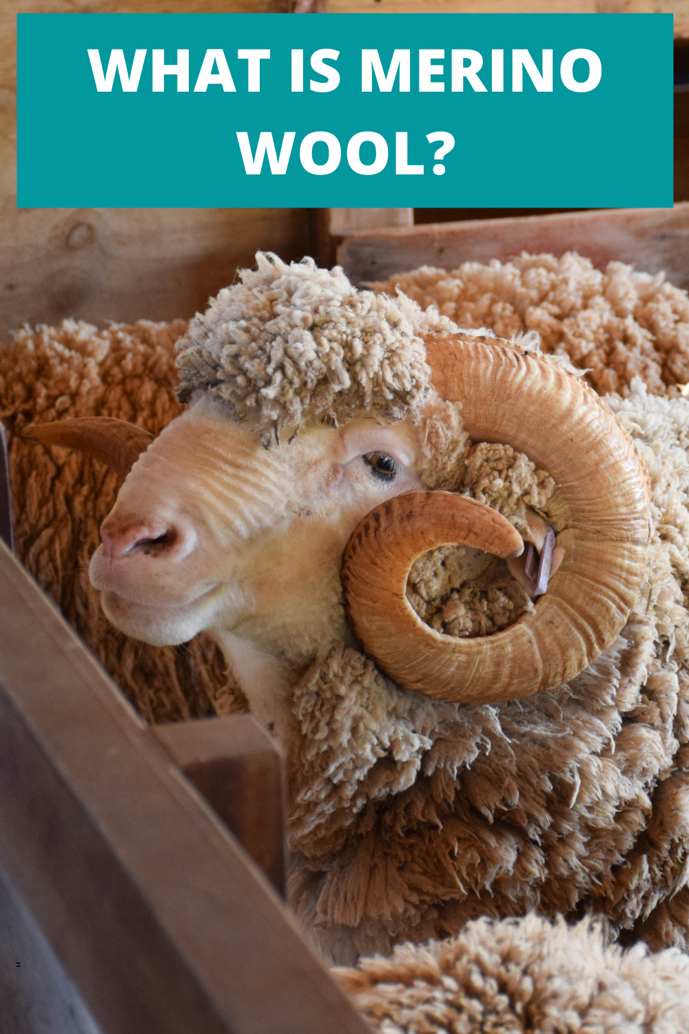
What Is Merino Wool? And Should You Use It?
Finding the appropriate material for your outdoor clothing is really important. The use of cotton in high output activities has been thought of as archaic for a while now. Cotton holds moisture and odour meaning you can feel wet and smelly pretty soon into a hike. Another option has been synthetic clothing that has improved the wicking performance of garments but odour has still be an issue. Step in Merino wool. Merino wool garments can offer exceptional performance in the mountains and below I outline why.
WHAT IS MERINO WOOL?
Merino Wool is a natural fibre that is grown on Merino sheep from New Zealand and Australia. Merino fibre benefits from being incredibly fine, making it softer than other types of wool. What makes Merino sheep, and in essence their wool, special is their ability to live in varying temperatures. Merino sheep are used to dealing with fluctuations from -20ºC upwards of 30ºC. This makes Merino a versatile material to use in the construction of outdoor garments as they can be utilised in many different environments.
WHY USE MERINO WOOL CLOTHES?
Do you enjoy getting outside? Do you like to get outside regardless of the weather? Do you take part in a range of winter and summer sports? Well if that sounds like you then merino could be the material you are looking for, as Merino wool lends itself to every adventure in every season. Naturally regulating your body temperature and wicking pesky moisture away from your skin, you can feel comfortable in Merino wool clothing from the first minute to the last. Even better, Merino wool is naturally odour resistant! Yes, you will sweat but smell less! Finally, and not to be forgotten, Merino wool is soft and incredibly comfortable against the skin.
ADVANTAGES OF MERINO WOOL
RENEWABLE
Merino wool is a natural fibre grown on sheep so it is also renewable. Merino sheep can group up to five lbs of wool per year and what’s even better? Merino sheep have lived in harsh environments and their wool is well naturally adapted to handle these climates.
Comparing Merino to synthetic or cotton equivalents shows that these alternatives need large amounts of processing before they are used in garments. Merino is a natural fibre and as such has less impact on the environment.
MERINO WOOL ODOUR RESISTANCE
A massive selling point for me is the odour resistance of Merino wool. I first came across Merino wool before a trekking trip in India, where I wanted to only pack a finite amount of clothing. Taking two t-shirts for a one month trip may seem daunting to many, especially in a hot country like India, but it worked a treat. Merino garments are capable of absorbing odour, preventing them from developing into that awful post-hike stench.
Dubious at first, years later I am still amazed at how Merino clothing remains odour resistant for way longer than synthetic equivalents.
TEMPERATURE REGULATION
Merino sheep need to survive in both hot and cold temperatures, meaning their wool is well adapted to both situations. A Merino garment will trap air for insulation in the cold but when it’s hot wick moisture away from the skin. This prevents that awful feeling when a cotton t-shirt gets wet due to excess sweat. A Merino t-shirt moves this moisture away from the skin and releases it as vapour. Synthetic fabrics also wick moisture away from the skin but they require an extra stage to do so, this can mean that synthetic garments are not as effective in cold climates.
MAKE A MERINO LAYERING SYSTEM
Layering systems are great for ensuring that you are just the right temperature at all stages of an activity. With the success of merino companies like Icebreaker and Smartwool more Merino clothing is finding its way into the market. What is great is now these companies are not just focused on base layers but full outfits. Layering a Merino jumper and jacket over a Merino t-shirt ensures that vapour can be wicked away efficiently.
MERINO WOOL IS COMFORTABLE
One reason many people avoid wool clothing is that they say it is itchy or uncomfortable. Well, Merino could just be the answer here as well. Merino wool is much finer than other wools meaning it is softer against the skin. In my experience, Merino doesn’t itch and I regularly use Merino t-shirts, hoodies and socks.
MERINO IS BIODEGRADABLE
It has already been mentioned the Merino has renewable qualities… well here is another reason that Merino is great for the environment. Being a natural fibre, Merino will decompose when put in a landfill. This means you can dispose of any old Merino garments without worrying about the future impact on the environment.

MERINO OFFERS UV PROTECTION
Those Merino sheep really have done all the hard work for us. Another benefit of Merino sheep’s evolution whilst living in hot temperatures is that Merino wool offers a natural UV barrier. This barrier to UV radiation protects the skin meaning you have less to worry about on those sunny days.
MERINO WOOL WARMTH TO WEIGHT
Merino wool offers an impressive warmth to weight ratio. Similar to down, Merino traps air between its fibres which helps create warmth. Merino’s natural loft ensures that it offers a very efficient temperature regulation.
MERINO WOOL IS STRONGER THAN COTTON
Merino wool fibres are stronger than cotton fibres. That’s right not only does your Merino t-shirt benefit from all of the above but it also is more durable than cotton.
DISADVANTAGES OF MERINO
There aren’t many… but here we go.
MERINO WOOL IS EXPENSIVE
Merino garments are more expensive than their cotton or synthetic equivalents, in the same way that a Ferrari is more expensive than a Fiat. Luckily there are companies trying to make Merino more affordable, check out ISOBAA who regularly have offers on SportPursuit.
DURABILITY ISSUES
Merino comes in different grades and the lighter garments (180 or lower) can be subject to holes. With lighter Merino garments pay particular attention to how you wash them. Avoid using fabric softener and do not overwash as this can leads to holes forming in the material. Remember Merino garments require less washing as they are naturally odour resistant.
IS MERINO FOR YOU?
Merino isn’t going to be worth the investment for everyone and that is ok. If however, you are a regular in the outdoors and you want the best performance from your garments then you should consider buying Merino wool clothing. I use a lot of my Merino garments in both summer and winter making the outlay worth it for me. I still search for deals and you can always pick up items in the sale making Merino more affordable.
IS MERINO ETHICAL?
Ethical concerns are becoming more prevalent across society and the outdoor community is no exception. It is worth noting that if you choose your Merino wool provider carefully, they will have sustainability and care for their animals at the core of what they do.
Merino is a natural fibre that has evolved over years of Merino sheep living in the harshest environments. The benefits of Merino in the outdoors are substantial and the effect on the environment little. Merino is a natural resource, it grows on sheep! No sooner have farmers sheered their sheep than the next coat of Merino wool begins to develop. Furthermore, Merino’s biodegradable properties ensure its environmental impact is negligible when discarded.

QUESTIONS ABOUT MERINO WOOL
WHAT’S SO SPECIAL ABOUT MERINO?
Merino wool is an amazing natural material that has many benefits. From odour resistance to temperature regulation, Merino wool can be beneficial in a range of activities.
WHY IS MERINO WOOL CONSIDERED SOFT?
Merino wool has elastic properties that ensure the fibres can retain their shape over time. This is one of the reasons that Merino garments do not need to be ironed… just hang them after washing. This natural resistance to wrinkling ensures that the garment remains smooth and soft against the skin with no itchiness.
IS CASHMERE BETTER THAN MERINO WOOL?
Cashmere has a higher loft than Merino ensuring it is softer. Durability wise, Merino is stronger so makes a better fabric for use in the outdoors.
WHY IS MERINO WOOL EXPENSIVE?
There are a number of reasons why Merino wool garments are expensive. Firstly, wool is a natural product and therefore requires time to grow. The process of farming Merino sheep is one that costs time and money. So sadly that price needs to be passed onto the consumer. Merino is super fine and therefore more merino wool is needed to complete one item in comparison to other wool products. More wool means a higher cost.
PIN THIS POST

MERINO PRODUCTS

Steel Knotts | Wainwright's Far Eastern Fells
Steel Knotts
Steel Knotts is one of the quieter, more compact fells tucked into the Far Eastern Fells of the English Lake District, sitting between Ullswater and Haweswater. At 432 metres (1,417 ft), it lacks the drama of the higher summits, but rewards walkers with unexpectedly fine ridge walking, interesting rocky features and clear views over Ullswater, Martindale and the Helvellyn range. Its position makes it a useful addition to longer walks — commonly paired with Hallin Fell, Loadpot Hill or as part of a circuit from Patterdale — yet it also works well as a short, sharp outing from the Ullswater shores.

Steel Knotts Summit Views
STEEL KNOTTS INFORMATION
Steel Knotts sits on the eastern flank of the Far Eastern Fells. Although longer walks to Steel Knotts can be accessed by linking the Ullswater Way from Glenridding or Patterdale, I have always accessed this diminutive fell from Howtown or Martindale.
Steel Knotts is a compact, craggy fell with a distinctive northern face that drops steeply toward the valley. The summit area is rocky underfoot in places, interspersed with grassy sections and low, wind-sheared heather. The fell feels more intimate than the higher central Lake District peaks — its ridges and rock outcrops give strong character and provide good scrambling on steeper sections for those comfortable with hands-on moves. Paths are well trodden but can be narrow and muddy after rain.
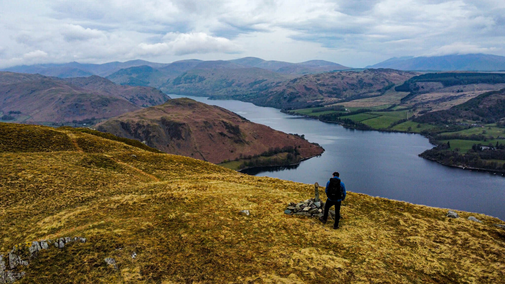
The summit is marked by a rocky outcrop that is distinctive and offers views which are excellent for the height. In one direction are views pictured above which take in the Nab and the Martindale Horseshoe. In the other direction is Ullswater and the nearby Hallin Fell.
Ullswater stretches out to the northeast with steep farmland and woods below, while the Helvellyn range towers to the west and south-west. To the east and north-east you get a clear sense of the Eden valley and the Pennine foothills beyond. On fine days the water-glass sheen of Ullswater framed by surrounding fells makes Steel Knotts a rewarding, compact viewpoint.
Steel Knotts works year-round. Spring and autumn give good colour and fewer crowds; summer brings longer daylight but more walkers. Winter conditions can make the crags icy.
For a relatively small fell, Steel Knotts offers dramatic local scenery, sweeping views over Ullswater and a satisfying, varied walk that can be short and sharp or part of a longer, more challenging day on the Far Eastern Fells. It’s ideal if you want mountain character without the sustained commitment of higher summits.
HEIGHT IN METRES 432m
HEIGHT IN FEET 1417ft
RANGE Far Eastern Fells
GRID REFERENCE NY 440 181
Have you walked Steel Knotts? Let me know below
STEEL KNOTTS VIDEO
STEEL KNOTTS MAP
STEEL KNOTTS GALLERY


RELATED POSTS
Arthur's Pike | Wainwright's Far Eastern Fells
ARTHURS PIKE
Arthur's Pike is a delightful summit that offers an excellent introduction to the Far Eastern Fells. The ascent is relatively gentle, making it suitable for hikers of all levels. Starting from Pooley Bridge, the route takes you through lush pastures and open moorland. As you climb higher, the views expand dramatically, revealing the shimmering waters of Ullswater below. Arthur’s Pike is a less frequented gem, providing a peaceful escape from the busier fells. The summit itself is marked by a modest cairn, but the true reward lies in the expansive vistas. On a clear day, you can see across the Eden Valley to the Pennines, with the dramatic Helvellyn range forming a stunning backdrop. Arthur's Pike may not be the highest fell, but its charm lies in its accessibility and the sense of tranquility it offers. It's an ideal spot for a relaxing hike with rewarding views.
Arthur’s Pike summit overlooks Ullswater in the Far Eastern Fells of the English Lake District. At 533m Arthur’s Pike is not tall enough to be recognised as a Nuttall however, it does make Arthur Wainwright’s list of 214 Lakeland Fells. The views from Arthur’s Pike are stunning on a clear day, with views across the lake and of surrounding Fells. Arthur’s Pike is a child summit of High Street. Arthur’s Pike is both a Wainwright and a Birkett.
ARTHUR’S PIKE INFORMATION
HEIGHT IN METRES 533m
HEIGHT IN FEET 1749ft
RANGE Far Eastern Fells
GRID REFERENCE NY 461 204
Have you walked Arthur’s Pike? Let me know below…
ARTHUR’S PIKE VIDEO
ARTHUR’S PIKE MAP
FREQUENTLY ASKED QUESTIONS
Frequently Asked Questions about Arthur's Pike in the Far Eastern Fells
What is Arthur's Pike?
Arthur's Pike is a captivating fell located in the Far Eastern Fells of the Lake District National Park in Cumbria, England. It stands at a modest height of 533 meters (1,749 feet) and offers stunning panoramic views of the surrounding countryside.
How do I reach Arthur's Pike?
The most popular starting point to access Arthur's Pike is from the village of Pooley Bridge. There are several walking routes available, all offering different levels of difficulty. One of the most commonly used paths starts from Roehead car park, situated a short distance from Pooley Bridge.
How long does it take to hike Arthur's Pike?
The duration of the hike largely depends on your fitness level and the route you choose. On average, it takes between 2 to 3 hours to reach the summit from Pooley Bridge. This estimate includes time for breaks and enjoying the panoramic view from the top.
What can I expect to see from Arthur's Pike?
The summit of Arthur's Pike rewards hikers with magnificent views over Ullswater, one of England's most beautiful lakes. On a clear day, you can also catch sight of the surrounding Fells, including Helvellyn and the Eastern Fells. The incredible scenery makes it an ideal spot for photography.
Are there any noteworthy landmarks near Arthur's Pike?
Yes, there are a few notable landmarks in the vicinity of Arthur's Pike. Nearby, you will find Bonscale Tower, an intriguing fortified tower dating back to the 15th century. Additionally, Heughscar Hill Fort, a well-preserved Iron Age fort, is located a short distance away.
Is Arthur's Pike suitable for beginners?
Yes, Arthur's Pike is a great choice for beginners and families looking to enjoy a scenic hike in the Lake District. The ascent is generally gentle, and there are no technical difficulties involved. However, it is always advisable to wear appropriate footwear and carry essentials like water, snacks, and a map.
Can I bring my dog along on the hike to Arthur's Pike?
Absolutely! Arthur's Pike is dog-friendly, so you are more than welcome to bring your furry friend along for the adventure. It is important to keep your dog under control and clean up after them to maintain the park's cleanliness and respect other.
Is Arthur’s Pike a Wainwright?
Yes, Arthur’s Pike is a Wainwright. Alfred Wainwright documented Arthur’s Pike in his second volume of The Pictorial Guides To The Lakeland Fells, The Far Eastern Fells.
RELATED POSTS