Loadpot Hill and Wether Hill Walking Route
Loadpot Hill and Wether Hill rise above the Martindale valley in the eastern Lake District, offering broad, grassy tops, fine views over Ullswater and the surrounding fells, and a quieter alternative to the busier central ridges. Loadpot Hill is a long, undulating fell with gentle gradients and expansive panoramas; Wether Hill delivers a slightly higher, rounded summit and the rewarding sweep of High Dodd and Angle Tarn on its flanks. Together they form a restful pair of summits that feel more like walking across open moorland than scrambling over craggy peaks.

Walking these fells from Martindale in a loop makes practical and aesthetic sense. Martindale provides a peaceful start and finish, with easy parking and a low-traffic lane that leads naturally onto the fell. A clockwise or anticlockwise circuit allows you to follow the ridgeline between the two tops, taking in the best viewpoints for Ullswater, Rampsgill, and the Helvellyn range while avoiding unnecessary backtracking.
Overall it’s an accessible, satisfying day out for walkers looking for wide skies and calm, unspoiled landscapes.
CLICK THE MAP BELOW TO VIEW THE FULL ROUTE
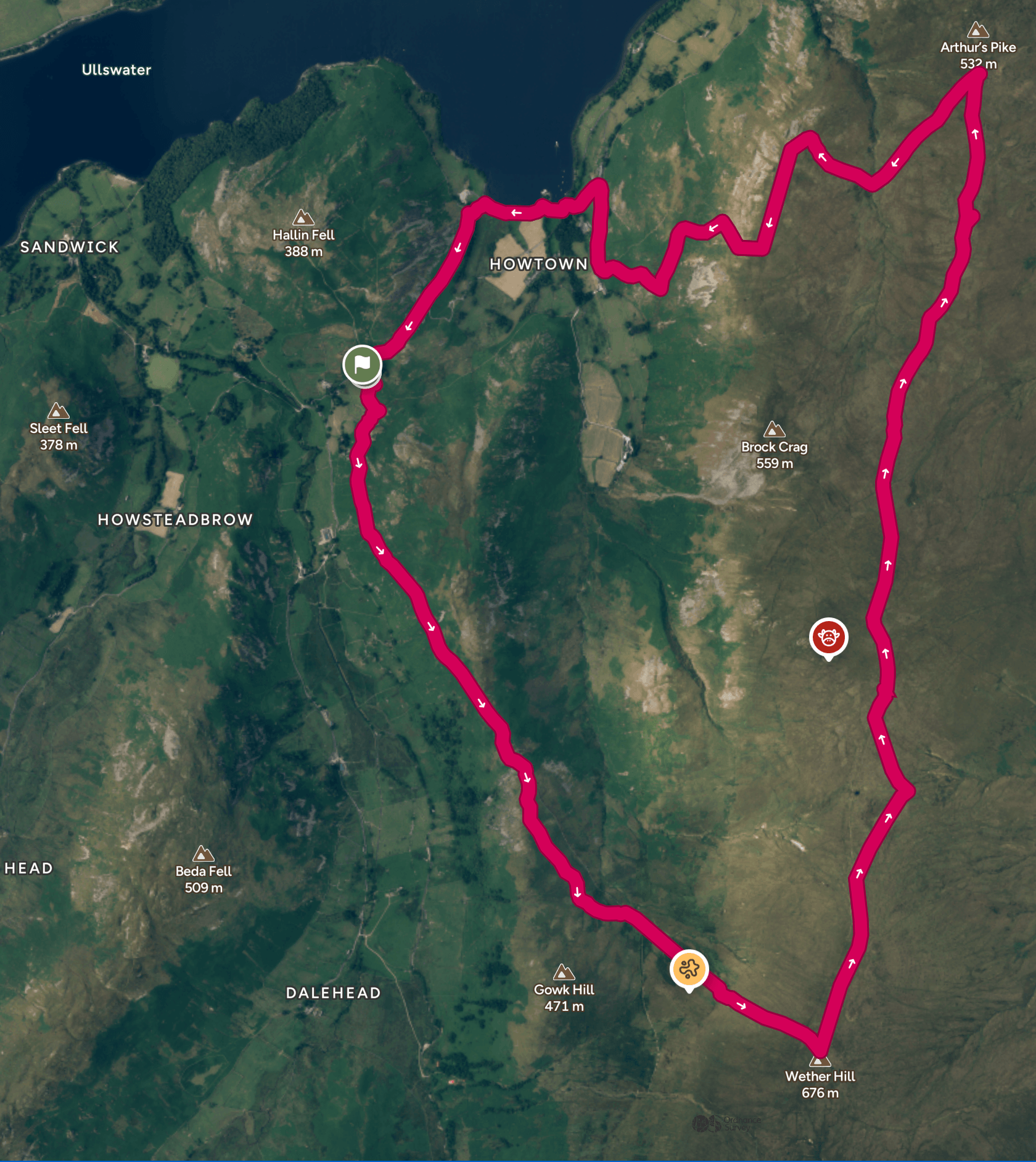
WALK OVERVIEW
Start - Martindale
Parking is available next to the church at the base of Hallin Fell in Martindale. This area can be busy during the summer months so please ensure you park sensibly to leave room for others. If this area is full, I often head further along to the “Old” Church. The Old Church has room for a few more cars and is often less contested.
If you want to avoid the parking panic, leaving your car at an all-day car park in Pooley Bridge and taking the Ullswater Steamer to Howtown is another great way to access this walk.
Distance - 8.21M
There are a few options that can reduce/increase the distance on this walk if you prefer. The short addition of Gowk Hill a non Wainwright Fell is a simple addition.
Duration.- 4hrs 30 - 5 hrs
Difficulty - Mellow
I grade this route as mellow as once on the ridge it is fairly gentle walking. The walk up to the ridge may be more moderate for some but taking your time it should be manageable for most.
Total Ascent - 2339ft